Things to do · Islands
Okushiri Island, Hokkaido: the ferry from Esashi, flights, the 1993 tsunami sites and what to see
Okushiri is an island of about 2,000 people in the Sea of Japan, 61 km north-west of Esashi on Hokkaido's south-west coast. This guide covers where it is and how it is laid out; the car ferry from Esashi, with the 2026 timetable, the fares and the rules for booking; flights from Hakodate and Sapporo; the town bus, rental cars and taxis; the 1993 earthquake and tsunami and the museum that records them; Nabetsuru-iwa and the other sights, area by area; and beaches, free campsites, food and winter. Timetables, fares and opening dates are those published by the ferry operator, the Town of Okushiri, the Okushiri Island Tourism Association and the Japan Meteorological Agency, checked on 12 October 2026; a list of the dates that will go out of date is near the end.
Last checked · Sources

In short
Okushiri Island lies off the south-west corner of Hokkaido. It is reached by a car ferry from Esashi that takes 2 hours 10 minutes (2 hours 20 minutes from December to March) and costs 3,490 yen one way in second class from October to December 2026, or by a flight of about 30 minutes from Hakodate Airport. The ferry sails once a day each way for most of the year and twice a day from late April to early May, in July and August and on some September days. The best-known sights are the rock arch Nabetsuru-iwa, about 15 minutes on foot from the ferry port, and the Okushiri Island Tsunami Museum at Aonae, open from 18 April to 31 October in 2026.
Where is Okushiri Island?
Okushiri Island lies in the Sea of Japan off the south-west corner of Hokkaido, the northernmost of Japan's four main islands. The Town of Okushiri places it 61 km north-west of Esashi and 42 km south-west of Setana, two towns on the Hokkaido coast, at 42°10′ north and 139°31′ east. The Hokkaido Tourism Organization puts it in one line: "Accessible by ferry from Esashi, Okushiri Island lies off southwestern Hokkaido."
| Measure | Figure |
|---|---|
| From Esashi | 61 km, to the north-west |
| From Setana | 42 km, to the south-west |
| North to south | 27 km |
| East to west | 11 km |
| Area | 142.99 km² |
| Coastline | 84 km |
| Highest point | Mount Kamui, 584.5 m |
| Population | 2,020 people in 1,294 households on 30 September 2026 |
A feature on the island published by the Japan National Tourism Organization (JNTO) places it at the far edge of the prefecture, saying that "Okushiri is the westernmost island off the coast of Hokkaido".
The town's own pages fill in the rest.
- One island, one town. The whole island is a single municipality, the Town of Okushiri (Okushiri-cho). The town's history page records that the island became a county of its own in 1869, a village in 1906 and a town in 1966.
- The name is Ainu. The town traces it to the language of the Ainu, the indigenous people of Hokkaido: an older form, Ikushun-shiri, was shortened to Iku-shiri, in which iku means the far side and shiri means island. Okushiri is the island over there.
- It is long from north to south. The town describes a trapezoid 27 km long and 11 km wide, built of granite terraces. Rivers cut down through the terraces, which is the town's explanation for the island's many waterfalls. The same page notes that sulphur was once mined here and that hot springs rise on the island.
- Most of it is forest. By the town's land-use figures about 71.4% of the island is forest, and the town says that more than about 60% of that forest is virgin beech. JNTO makes the same point: "The island is known for its virgin beech forests, which have long contributed to and regenerated the natural cycle of life here."
- The beech explains the rice. Beech woods hold water. The town credits them with rivers that almost never run dry and with rice fields, and it describes Okushiri as the only remote island of Hokkaido where rice is grown. Paddies are about 1.0% of the land.
- Three peaks. Mount Kamui is the highest at 584.5 m, followed by Katsuma-yama at 427.7 m and Mount Tamashima at 369.3 m. The third is the one with a viewing deck that visitors drive up to, and it is described in the section on the north of the island.
- Second among Hokkaido's islands. In the town's wording Okushiri is the second-largest island of Hokkaido by area, after Rishiri.
- A natural park. The Hiyama Prefectural Natural Park was designated on 20 April 1960 and covers 17,013 hectares. The town says that all of Okushiri lies inside it.
Okushiri Island map: the four areas
The Town of Okushiri sorts the island's sights into four areas, and they sit on the four sides of the island: the ferry port on the east coast, Cape Inaho at the northern tip, Kamuiwaki on the west coast and Cape Aonae at the southern tip. The map below shows the whole island; the ferry from Esashi arrives on the east side, and the airport is in the south.
| Area | Where | Main sights | From the ferry terminal |
|---|---|---|---|
| Around Okushiri port | East coast | Nabetsuru-iwa, the Unimaru monument, the ferry terminal | Nabetsuru-iwa is about 15 minutes on foot |
| Cape Inaho | Northern tip | Sai-no-Kawara, the Inaho lighthouse, Miyatsu Benten-gu, Mount Tamashima | Sai-no-Kawara is about 10 km, or 15 minutes by car |
| Kamuiwaki | West coast | Kamuiwaki Onsen, Cape Kitaoi, Muen-jima and the sea stacks | Cape Kitaoi is about 15 km, or 25 minutes by car, by way of Horonai |
| Cape Aonae | Southern tip | Okushiri Island Tsunami Museum, the Jikusho memorial, the Tokuyo monument, Okushiri Airport | The airport is about 30 minutes by taxi |
The times and distances in the last column are the ones given by the town, the ferry operator and the Hokkaido Tourism Organization. Three things follow from them.
- The port area can be seen on foot. Nabetsuru-iwa, the rock arch that appears on most pictures of the island, is a 15-minute walk from the ferry. The Hokkaido Tourism Organization names it first among the island's landscapes: "Its coastline features dramatic landscapes, including iconic Nabetsuru Rock, a natural arch that symbolizes the island."
- Everything else needs wheels. The tsunami museum is 21.5 km from the ferry terminal along the bus route, and the hot spring on the west coast is further still. The section on getting around has the bus times.
- There are two ways to the west coast. The town's campsite page gives Cape Kitaoi as about 15 km and 25 minutes from the ferry terminal by way of Horonai, or about 33 km and 45 minutes by way of Aonae in the south. The town bus takes the southern way.
For a sense of how long a circuit takes, the scheduled sightseeing taxi listed by the tourism association ran a round-island course from 13:15 to 17:30 in 2025, a little over four hours including a stop at the tsunami museum.
JNTO's page on the island sums up the kind of trip it is: "From walking and cycling to filling up on fresh seafood or relaxing in a hot spring, Okushiri Island repays adventurous travelers who make the detour to this ruggedly beautiful island off the southwestern corner of Hokkaido."
How to get to Okushiri Island
JNTO states the choice plainly: "You can reach the island by ferry or plane."
| Route | Time | How often | Fare |
|---|---|---|---|
| Ferry from Esashi | 2 hours 10 minutes; 2 hours 20 minutes from December to March | Once a day each way for most of the year; twice a day on some days between late April and September | 3,490 yen one way in second class, 1 October to 31 December 2026 |
| Flight from Hakodate | About 30 minutes | Five days a week until 30 November 2026; daily from 1 December 2026 to 28 February 2027 | Not on the pages read, so this site does not quote one |
| Flight from Sapporo Okadama | About 50 minutes | Fridays and Sundays until 30 November 2026; suspended from 1 December | Not on the pages read, so this site does not quote one |
Both routes start in the south of Hokkaido, and for most visitors that means Hakodate. JNTO describes the surface route from there: "From Hakodate, it is a two-hour bus ride to the port of Esashi, from where it is a further two hours by ferry to Okushiri Island." The operator's timetable gives the crossing as 2 hours 10 minutes for most of the year.
Getting to Hakodate first
A JNTO feature about a guided trip to the island sets its meeting point at Hakodate Airport and lists the flights that reach it: "Domestic flights are available from Tokyo Haneda Airport (about 1 hour 20 minutes), Chubu Centrair International Airport in Nagoya (about 1 hour 30 minutes), and Osaka International Airport in Itami (about 1 hour 35 minutes)." How flights inside Japan work, and the cheap fares open to overseas visitors, are on the domestic flights page.
Ferry or plane?
- Only the ferry takes a car. The ship carries cars, motorbikes and bicycles, and the vehicle fares are in the fares section below. A car needs a booking; a foot passenger in second class does not.
- The plane is quicker but there is one a day. The Town of Okushiri lists one round trip a day on each air route, flown with a 48-seat propeller aircraft. The ferry carries 460 passengers.
- The ferry timetable forces a night on the island for most of the year. On days with one round trip the ship leaves the island in the morning and returns from Esashi in the afternoon. The timetable section explains what that means for a day trip.
- The two can be combined. Nothing on the pages read ties a traveller to one route, so sailing out and flying back, or the reverse, is a matter of two separate bookings.
Is there a ferry from Setana?
The town's history page mentions scheduled ferries to both Esashi and Setana. The operator's 2026 timetable lists the Esashi route only, and this page covers Esashi only.
Okushiri Island ferry: the 2026 timetable from Esashi
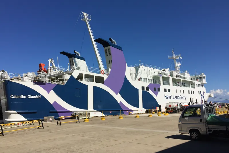
One ship, the Calanthe Okushiri, works the route between Esashi and Okushiri. The operator's 2026 timetable runs from 1 January to 31 December and changes with the season. This site's own visit in September 2018 was made on this route, on the ferry from Esashi, and this site's own photographs of the ship are from that trip.
| Period in 2026 | Leaves Okushiri | Arrives Esashi | Leaves Esashi | Arrives Okushiri |
|---|---|---|---|---|
| 1 January to 31 March | 08:15 | 10:35 | 13:00 | 15:20 |
| 1 to 24 April | 07:00 | 09:10 | 13:00 | 15:10 |
| 25 April to 6 May | 07:00 and 15:00 | 09:10 and 17:10 | 09:40 and 17:40 | 11:50 and 19:50 |
| 7 May to 30 June | 07:00 | 09:10 | 13:00 | 15:10 |
| 1 July to 31 August | 07:00 and 15:00 | 09:10 and 17:10 | 09:40 and 17:40 | 11:50 and 19:50 |
| September, weekdays outside the holiday run | 07:00 | 09:10 | 13:00 | 15:10 |
| September, 5–6, 12–13 and 19–23 | 07:00 and 15:00 | 09:10 and 17:10 | 09:40 and 17:40 | 11:50 and 19:50 |
| 1 October to 30 November | 07:00 | 09:10 | 13:00 | 15:10 |
| 1 to 31 December | 07:30 | 09:50 | 13:00 | 15:20 |
In September 2026 the two-round-trip days were Saturday 5 and Sunday 6, Saturday 12 and Sunday 13, and the five days from Saturday 19 to Wednesday 23. Every other day of the month had one round trip.
The table repays a careful reading.
- The ship's day begins and ends at Okushiri. The first sailing of the day leaves the island and the last one arrives there. On a one-round-trip day a visitor who lands at 15:10 cannot leave before 07:00 the next morning, so a visit means at least one night.
- On two-round-trip days there is no 13:00 from Esashi. The departures from Esashi move to 09:40 and 17:40. Anyone who has read 13:00 on an older page and arrives in Esashi at noon in July will find the morning ship gone and nearly six hours to wait.
- A day trip from Esashi is possible only on two-round-trip days, and it is short. The 09:40 lands at 11:50 and the afternoon sailing leaves the island at 15:00. That is 3 hours 10 minutes between ship and ship, and the check-in deadline takes 30 to 40 minutes off the end. It is time for Nabetsuru-iwa and lunch near the port, not for the tsunami museum at the other end of the island.
- From the island, a day trip to the mainland works in the same seasons. Islanders and anyone staying on Okushiri can take the 07:00, have from 09:10 to 17:40 in Esashi, and be back at 19:50.
- Winter crossings are ten minutes longer. From 1 December to 31 March the crossing is timed at 2 hours 20 minutes. The morning ship leaves the island at 07:30 in December and at 08:15 from January to March.
- Extra sailings are possible. A note under the timetable says that, besides the scheduled sailings, up to two extra sailings a day may be run when they are needed.
What about 2027?
The timetable on the operator's site ends on 31 December 2026. The 2026 timetable was announced in a notice dated 31 October 2025, and the 2027 timetable was not on the site on 12 October 2026. The seasonal pattern above is a guide to what a year looks like, but the dates and times for 2027 are the operator's to announce, and this page will be updated when they appear.
Okushiri ferry fares from 1 October 2026
A foot passenger pays 3,490 yen one way in second class between Esashi and Okushiri from 1 October to 31 December 2026, tax included. The operator revised its fares on 1 October 2026 and publishes a separate table for each three-month period, so every figure in this section holds until 31 December 2026 and no further.
| Class | One way, adult | Can it be booked? |
|---|---|---|
| Second class | 3,490 yen | No; it is bought at the counter on the day |
| Second-class reserved seat | 4,150 yen | Yes |
| First-class Island View Seat | 6,420 yen | Yes |
| Special room | 20,000 yen a room, plus 3,490 yen a person | Yes |
- Second class is the ordinary ticket. It buys a place in the shared second-class rooms, and it is the class in which a car's driver travels.
- A reserved seat is the second-class fare plus a seat fee. The seat fee is 660 yen for an adult on this route, which is how 3,490 yen becomes 4,150 yen. The reserved seats are reclining seats with tables.
- The Island View Seat is first class. The 6,420 yen includes the seat fee. The operator describes reclining seats with footrests, placed for watching the outline of the island and the sea.
- The special rooms are charged by the room. There are two, each for a group of one to four people. Every person pays the second-class fare and the group pays 20,000 yen for the room on each crossing. One room is laid out in Japanese style and the other in Western style with reclining seats.
- Children. Primary-school pupils pay half the adult fare and half the seat fee, rounded to the nearest 10 yen. One adult may take two children aged one or over who have not yet started primary school free of charge, unless a reserved seat or something similar is taken for them. The fare page does not mention babies under one.
Cars, motorbikes and bicycles
| Vehicle or baggage | One way |
|---|---|
| Car under 3 m long | 16,530 yen |
| Car of 3 m to under 4 m | 21,540 yen |
| Car of 4 m to under 5 m | 27,260 yen |
| Car of 5 m to under 6 m | 33,120 yen |
| Bicycle | 2,340 yen |
| Motorbike under 125cc | 4,730 yen |
| Motorbike of 125cc to under 750cc | 7,080 yen |
| Motorbike of 750cc and over | 9,410 yen |
| Checked baggage, a piece | 650 yen |
The operator's table goes on in one-metre steps to vehicles of under 12 m, at 70,060 yen, and adds 6,260 yen for each further metre.
- A car fare includes its driver. One driver travels in second class on the car's ticket. A car of 4 m to under 5 m with its driver and one adult passenger therefore costs 27,260 yen plus 3,490 yen, which is 30,750 yen one way.
- Length means total length. The band is set by the length of the vehicle including any load or coupled trailer. The fares above are for widths up to 2.5 m; a wider vehicle pays 15% more for every 25 cm over.
- Bring the vehicle inspection certificate. The operator asks drivers to show the car's shaken-sho at the counter.
- The same car coming back gets 10% off. The discount applies to the return-leg car fare for the same vehicle, and the return ticket is valid for 14 days including the day it is sold.
- Booking a vehicle on the web takes 5% off. The web discount cannot be combined with any other discount.
- Bicycles and motorbikes are charged as special baggage. The fare page lists them apart from cars and, unlike the car fare, does not say that the charge includes the rider's passage.
A visitor without a car can cross on foot and rent one on the island; the section on getting around has what the pages say about rental cars.
The fare page lists other discounts as well: books of coupon tickets sold as eleven for the price of ten and valid for two months, 10% off for groups of 15 or more, and a discount for passengers with a disability certificate. Discounts cannot be combined with each other.
The fuel surcharge. The operator has added a fuel surcharge that moves with the price of fuel since 1 July 2022 and reviews it every three months. In the table for 1 October to 31 December 2026 it is shown as 0 yen for every class and vehicle. A notice dated 24 July 2026 says the figure for 1 January to 31 March 2027 will be announced in October 2026; it was not on the fare page on 12 October 2026.
The free return ticket campaign
A campaign with its own website, Yokoso! Okushiri-to Taiken Program, gives the return crossing free to visitors who stay a night on the island and join an activity. A notice on the site dated 9 April 2026 says that the campaign for fiscal 2026 began on 17 April and is limited to 1,000 people. The site gives no closing date and no running count of the places left, so ask at the Esashi counter before counting on it. The steps it sets out are these.
- Book a lodging and an activity yourself. Both have to be on the lists of participating lodgings and experience programmes on the campaign site.
- Buy a one-way ticket at the Esashi counter. A ticket bought as a return is not refunded for its return half.
- Get the application form and stick the one-way ticket on it. The form is handed out at both ferry terminals and at the island's tourist information office, and it can be printed from the campaign site.
- Collect two stamps on the island. One comes from a participating lodging after a stay of at least one night, and one from a participating programme joined at least once.
- Hand in the form when leaving. Do not buy a ticket for the return. Fill in the form and its questionnaire and hand it in at the counter of the Okushiri ferry terminal, where it is exchanged for the return ticket.
The limits matter as much as the steps. The offer cannot be combined with a return ticket, the group discount, a car ferry fare or any other discount ticket, though the disability discount is accepted. The passage of a driver that is included in a car fare does not count. If the outbound ticket is lost the form is void. The free ticket is a second-class one, worth 3,490 yen at the fares of October to December 2026, and a passenger who wants a better class pays the difference. In short it is an offer for people who cross on foot.
Booking, check-in and boarding
Second class cannot be booked on the Okushiri route: the ticket is bought at the terminal counter on the day of sailing. Cars and the three reserved classes can be booked from two months before the sailing, on the operator's website or by phone between 9:00 and 17:00. Each kind of ticket has its own deadline at the counter.
| What | Can it be booked? | Finish at the counter by |
|---|---|---|
| Second class, on foot | No; buy it on the day | 30 to 40 minutes before departure |
| Reserved seat, Island View Seat or special room | Yes, from two months before | 20 minutes before departure |
| Car, sidecar or trike | Yes, from two months before | 40 minutes before departure |
| Motorbike or bicycle | No | 1 hour before departure |
- The counter opens one hour before departure. The operator adds that the time can differ by season. A rider with a motorbike or a bicycle needs to be there as it opens.
- Second class is sold until the ship is full. The operator refuses boarding once the ship has reached its capacity, which is why it asks second-class passengers to finish 30 to 40 minutes ahead.
- A booking can lapse. A booked seat that has not been ticketed 20 minutes before departure, or a booked car that has not been ticketed 40 minutes before, may be cancelled.
- Two wheels need a full hour. On the Okushiri route motorbikes and bicycles check in an hour before departure, because loading of the other vehicles starts after that and a late rider may not be led to the bike space. The space is limited, and boarding is refused when it is full.
- Booking opens two months ahead, on the same date. For a round trip the return crossing can be booked at the same time as the outward one if it falls within 14 days of it.
- Same-day bookings are limited to later sailings. They are taken only for sailings that leave at 11:00 or later, and they close two hours before departure. The morning sailing from the island cannot be booked on the day; the 13:00 from Esashi can, until 11:00.
- A booking needs a name and a contact phone number. Groups of 15 or more book in a different way, and the operator asks them to get in touch.
- Cancelling is free. A booking is cancelled by phone with its booking number, and the operator's FAQ says there is no cancellation fee.
- The waiting list is for cars only. The FAQ says that cars can be put on a waiting list and that there is none for any of the passenger cabins.
The operator's English page says nothing about the Okushiri route. Everything in this section comes from its Japanese pages, and a visitor who does not read Japanese is likely to find the counter simpler than the booking form: a foot passenger in second class needs no booking at all.
Paying. The counters take cash and credit cards; the operator names VISA, MasterCard, JCB, American Express and Diners. Touch payment and QR-code payment have been accepted at both counters on the Okushiri route since Friday 24 April 2026. A change to a better class made on board is paid for in cash only. There are ticket machines as well, but the operator sends anyone using a discount, or a credit card without a PIN, to the counter. How cards and cash work across the country is on the cash or card page.
When the ferry is cancelled
Sailings are cancelled in bad weather. The operator names wave height, wind direction and wind speed as the things it weighs, and it warns that a sudden change can also alter the port a sailing uses.
- Nobody phones. The operator does not contact passengers when a sailing is cancelled, with or without a booking. The day's decision is posted on the operation-status page of its website, and its LINE account sends news when sailings are not running normally.
- The decision comes early. On 12 October 2026 the status page showed the Okushiri route running normally, with the decision time-stamped 5:30. The phone lines for operation news open at 05:30 from 1 April to 30 November, at 06:00 in December and at 06:45 from 1 January to 31 March.
- A cancelled sailing cancels the booking. The operator treats the booking as cancelled, so a new one has to be made for another day.
- One sailing a day means a day lost. For most of the year there is one departure a day from each port. A cancelled morning sailing from the island puts the traveller back at least 24 hours, so it is unwise to hang a flight home on the day after the crossing.
- Where to sit. For anyone worried about the motion of the ship, the operator's advice is to stay low in the ship and near its middle, where there is less of it.
On board
- Bring food. The ship has vending machines for drinks and no restaurant, and a notice from the operator says the on-board shop stopped trading after Thursday 20 March 2025. The crossing is more than two hours.
- Foot passengers board by a gangway. Cars wait in the waiting area behind the ship. Only the driver boards with the vehicle; everyone else in the car walks on by the gangway.
- Getting off takes a little time. The operator says it can be about 10 minutes after the ship berths before passengers leave.
- A folding bicycle in a bag travels free. The condition is that the three sides of the bag add up to no more than 2 m and the weight is no more than 30 kg. Baggage handed over to the operator within the same limits is charged at 650 yen a piece.
- Pets. The operator asks owners to contact the branch in advance. The animal travels in a cage, the owner follows the cabin crew's directions, and a written pledge is filled in at the counter.
At Esashi: the boarding place has moved
Since Thursday 1 October 2026 the ship has used a different quay at Esashi, the new north pier, while works go on at the usual one. Tickets are still sold at the ferry terminal, and a free shuttle bus runs between the terminal and the ship.
- The arrangement is planned to last until Sunday 28 February 2027. The operator's notice of 28 September 2026 gives that period and says it may change with the progress of the works.
- Everything is finished at the terminal first. The notice asks passengers to complete the procedures at the terminal 40 minutes before departure and then board the shuttle bus in front of the building. At Esashi a foot passenger should therefore work to 40 minutes, not 30.
- Anyone may ride the shuttle, free. Its timetable for 1 October to 31 December 2026 is published in the notice as an image, and this page does not transcribe it.
- The shuttle times for 2027 are still to come. The notice says they will be announced once the 2027 sailing schedule has been decided.
Terminals and parking
Both terminals have a free car park beside them, each run by its town.
| Terminal | Where | Car park |
|---|---|---|
| Esashi Port Ferry Terminal | The north pier of Esashi port | Free, about 20 spaces, run by the Town of Esashi |
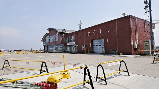
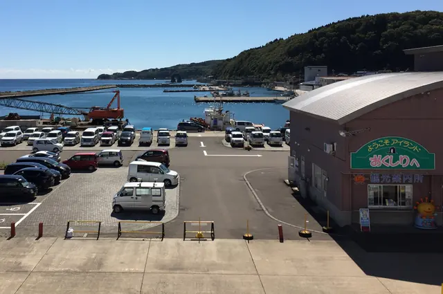
| Okushiri Port Ferry Terminal | Okushiri port, in the Okushiri district on the east coast | Free, about 30 spaces, run by the Town of Okushiri |
The operator attaches a warning to the first of them: the Esashi car park may be unusable until about 31 March 2028 because of the quay works. Anyone planning to leave a car at Esashi and cross on foot should ask the operator before setting out.
For drivers coming from Hakodate the operator's directions to the Esashi terminal are to follow Route 227 towards Esashi town hall, go about 200 m past it, and turn right at the junction beside the electric power company's office; the terminal is straight ahead. On the island the terminal is reached from the town hall by heading towards the sea, turning left at the first traffic signal and, 500 m further on, turning right at a petrol station.
The ship: Calanthe Okushiri
The Calanthe Okushiri is a passenger and car ferry of 3,631 gross tons that entered service in May 2017. It is the only ship on the route, which is why the timetable is built around a single vessel that starts and ends its day at the island.
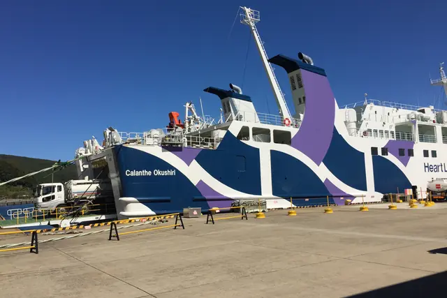
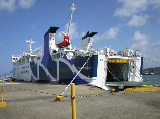
The name. The operator explains that the ship is named after Okushiri-ebine, an orchid that flowers on the island. It describes a delicate pale-purple flower so rare that it is on the red list, and it took the plant's scientific name, Calanthe, which it derives from the Greek words for beautiful and flower. It is the second ship in the group to be named after the scientific name of a flower from the island it serves.
The cabins. The operator's page on the ship lists these.
- Second-class rooms. The room at the stern is a ladies' room, and it connects to a powder room.
- Second-class reserved seats. Reclining seats with tables.
- Second-class priority seats. Reclining seats with room alongside for passengers who board in a wheelchair. The operator describes the ship as fitted with barrier-free facilities.
- First-class Island View Seats. Reclining seats with footrests.
- Two special rooms. Premium Blue is a Japanese-style room, which the operator suggests for families and small groups, and Premium Ocean is a Western-style room with reclining seats.
- A kids' room. A play room for small children, with coloured cushions.
The company. The operator's company page lists three companies in one group: a holding company set up in Sapporo in October 2024; Heartland Ferry, founded in Wakkanai in July 1934, with three ships; and Okushiri Island Ferry Co., Ltd., set up in October 2024, which has one passenger and car ferry, a head office at Okushiri port that is open all year from 9:00 to 17:00, and a branch at Esashi. This site's own photographs of the ship were taken in September 2018 and show the words Heart Land Ferry on the hull.
Getting to Esashi from Hakodate
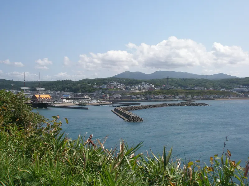
Esashi is reached from Hakodate by a route bus that takes a little over two hours and costs 2,500 yen, or by car on Route 227 in about 1 hour 17 minutes. The ferry terminal is a few minutes on foot from the bus stop Ubagami-cho Ferry-mae.
| From | How | Time | Fare |
|---|---|---|---|
| Hakodate Station or Hakodate Bus Centre | Hakodate Bus route 610 | About 2 hours 15 minutes | 2,500 yen |
| Kikonai Station | Hakodate Bus route 631 | About 1 hour 30 minutes | 1,900 yen |
| Hakodate, by car | Route 227 | About 1 hour 17 minutes | Fuel only |
The fares are from Hakodate Bus's fare tables for the two routes, to the stop Ubagami-cho Ferry-mae; the table for route 631 is marked as revised on 22 November 2024. The times are the ones given by the Okushiri Island Tourism Association, which also describes the Hakodate bus as running from Hakodate Station and Shin-Hakodate-Hokuto Station. No fare from Shin-Hakodate-Hokuto was on the pages read, so this site does not quote one.
- Get off at Ubagami-cho Ferry-mae. The tourism association gives the walk from the stop to the terminal as 3 minutes and the ferry operator as about 5.
- Check the bus times against the sailing. This page does not give a bus timetable. Hakodate Bus changed to its winter timetable on 1 October 2026, and the sailing times change with the season as well. For the 13:00 sailing the procedures at the Esashi terminal now close 40 minutes before departure, at 12:20.
- Some buses run on weekdays only. In August 2025 the ferry operator passed on a warning from Hakodate Bus that several buses would not run while the weekend and holiday timetable was in force over the Obon holiday. Among them were a bus leaving Hakodate Station at 06:48 and reaching Ubagami-cho Ferry-mae at 09:04, and one leaving Kikonai Station at 15:05 and reaching the stop at 16:40. Those were 2025 times, but they show how long the ride is, 2 hours 16 minutes from Hakodate and 1 hour 35 minutes from Kikonai, and that a bus seen on a weekday timetable may not exist on a Saturday.
- The bus back. The ship from the island reaches Esashi at 09:10 from April to November, at 09:50 in December and at 10:35 from January to March. The same check applies in this direction.
- By car. The tourism association gives about 1 hour 17 minutes from Hakodate on Route 227. The terminal car park is free but may be closed by the quay works, as the section above explains.
How buses in Japan are boarded and paid for is on the Japan bus guide.
Flights to Okushiri Airport
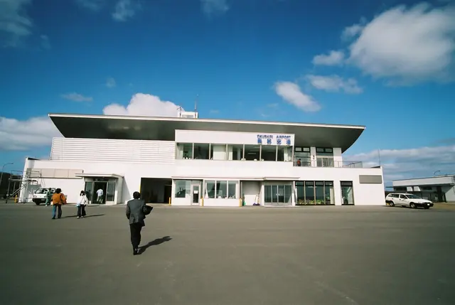
Okushiri has an airport at the southern end of the island with one round trip a day from Hakodate and, until 30 November 2026, a round trip from Sapporo Okadama on Fridays and Sundays. JNTO puts the case for flying in a sentence: "Much quicker is the direct flight from Hakodate Airport, which gets you there in around 30 minutes."

| Route | Period | Days | To Okushiri | From Okushiri |
|---|---|---|---|---|
| Hakodate | 24 September to 30 November 2026 | Monday, Tuesday, Wednesday, Thursday and Saturday | JAL2791, 11:45 to 12:15 | JAL2792, 12:45 to 13:15 |
| Hakodate | 1 December 2026 to 28 February 2027 | Every day | JAL2791, 11:20 to 11:50 | JAL2792, 12:20 to 12:50 |
| Sapporo Okadama | 24 September to 30 November 2026 | Friday and Sunday | JAL2795, 11:25 to 12:15 | JAL2796, 12:45 to 13:35 |
| Sapporo Okadama | From 1 December 2026 | Suspended | None | None |
The table is the Town of Okushiri's, last updated on 18 September 2026.
- The two routes share the week. Until 30 November the Okadama flight runs on the days the Hakodate flight does not. The town's page also lists exceptions: over the long weekend of 9 to 12 October 2026 the two routes swapped days. Check the date, not only the day of the week.
- From 1 December there is only Hakodate. The Hakodate flight becomes daily and the Okadama flight is suspended. The town's page gives no date for its return.
- The aircraft has 48 seats. The town describes the flights as Japan Airlines services flown with an ATR 42-600, a propeller aircraft with 48 seats, and the photograph on its page is captioned as an ATR 42 of Hokkaido Air System. The flight takes about 30 minutes from Hakodate and about 50 minutes from Okadama.
- The plane is on the ground for half an hour. It lands, turns round and leaves, so a day trip by air alone is not possible. Flying one way and sailing the other is.
- Okadama is not New Chitose. The Sapporo flight uses Sapporo Okadama Airport, which is a separate airport from New Chitose Airport. Check which one a connecting flight uses.
- Check with the airline. The town warns that the schedule can change and refers readers to JAL's website. No air fare is on the pages read, so this site does not quote one. The same goes for the check-in deadline.
- After 28 February 2027. The town's table stops there.
Between the airport and the rest of the island
The airport is at the southern end of the island, 24.4 km from the ferry terminal along the bus route and 2.9 km beyond the Tsunami Museum stop.
- By taxi. The ferry operator gives about 30 minutes and about 5,000 yen between the airport and the Okushiri ferry terminal, as a guide.
- By shared taxi. The tourism association says a shared taxi has linked the airport with the Okushiri district, including the Inaho and Miyatsu direction, since 1 February 2018. Its page gives no times or fares.
- By town bus from the plane. Until 30 November the flights land at 12:15 and a southern-line bus leaves the airport at 12:40, calls at the Tsunami Museum stop at 12:46 and reaches the ferry terminal at 13:28. From 1 December the flight lands at 11:50 and the same bus applies. For the west coast, buses leave the airport at 13:19 and 16:34.
- By town bus to the plane. The 11:00 bus from the ferry terminal reaches the airport at 11:41. The flight to Hakodate leaves at 12:45 until 30 November and at 12:20 from 1 December.
- Not at New Year. The town bus does not run from 31 December to 2 January.
How domestic flights are booked and what overseas visitors pay is on the domestic flights page.
Getting around Okushiri Island
The island has a town-run bus with three lines and a flat fare of 200 yen, six car-rental firms, one taxi company and a ferry that carries bicycles. The Hokkaido Tourism Organization's summary is short: "Getting around is convenient by rental car or bicycle, and travelers can unwind in a hot spring after exploring the island." The bus works too, for a visitor who plans around its timetable, and the tables below are that timetable.
The town bus: fares and rules
- 200 yen, whatever the distance. The fare is flat on every line. People who qualify for the town's discount scheme pay 100 yen.
- Pay as you board, in cash. The town says the bus does not take cashless payment and asks passengers to have the fare ready in coins so that no change is needed.
- Visitors may ride. The town's outline of the service lists visitors and tourists among its passengers. It runs six vehicles with seven drivers.
- Three lines. The northern line runs from the ferry terminal to Nonamae, past Sai-no-Kawara. The southern line runs from the ferry terminal to Okushiri Airport through Aonae. The west-coast line runs from the airport to Kamuiwaki Onsen. The names date from 1 October 2026 and were chosen, the town says, to be easy for visitors to understand.
- Eleven runs a day. Six on the southern line, four of which have a west-coast bus, and five on the northern line.
- Hail and ride. Outside the stops the bus can be flagged down by raising a hand, and a passenger who wants to get off between stops tells the driver in advance. It is not allowed in part of the Okushiri town centre, on one short stretch named by the town, or wherever the driver judges it unsafe.
- A pick-up can be booked. Since 1 October 2026 a passenger who phones the town's bus centre by the day before can be picked up or set down at an agreed safe place on the route. The bus centre takes bookings on weekdays from 8:30 to 17:15. Without a booking the bus is used exactly as before.
- No buses at New Year. There is no service from 31 December to 2 January.
Southern line: ferry terminal, Aonae and the airport
Times are from the town's timetable in force from 1 October 2026. Run 1 does not run on Saturdays, Sundays, public holidays or during school holidays, and run 2 runs only on those days, so on any one day there are six buses each way.
| Stop | Run 1 | Run 2 | Run 3 | Run 4 | Run 5 | Run 6 | Run 7 |
|---|---|---|---|---|---|---|---|
| Ferry Terminal, leaves | 6:12 | 7:05 | 9:20 | 11:00 | 12:30 | 14:14 | 15:45 |
| Nagahama | 6:27 | 7:24 | 9:39 | 11:19 | 12:56 | 14:40 | 16:11 |
| Tsunami Museum | No call | 7:40 | 9:55 | 11:35 | 13:12 | 14:56 | 16:27 |
| Okushiri Airport, arrives | No call | No call | 10:01 | 11:41 | 13:18 | 15:02 | 16:33 |
Runs 1 and 2 turn towards the west coast before the airport.
| Stop | Run 1 | Run 2 | Run 3 | Run 4 | Run 5 | Run 6 | Run 7 |
|---|---|---|---|---|---|---|---|
| Okushiri Airport, leaves | No call | No call | 10:04 | 12:40 | 13:57 | 15:05 | 16:38 |
| Tsunami Museum | 7:22 | 8:30 | 10:10 | 12:46 | 14:03 | 15:11 | 16:44 |
| Ferry Terminal, arrives | 8:04 | 9:12 | 10:52 | 13:28 | 14:45 | 15:46 | 17:19 |
West-coast line: the airport to Kamuiwaki Onsen
The west-coast runs keep the numbers of the southern runs they connect with. Runs 1, 2, 4 and 5 are through buses from the ferry terminal with no change. Run 7 is a separate vehicle, planned to be worked by a different operator, so a passenger from the 15:45 southern bus changes at the airport.
| Stop | Run 1 | Run 2 | Run 4 | Run 5 | Run 7 |
|---|---|---|---|---|---|
| Okushiri Airport | No call | No call | 11:42 | 13:19 | 16:34 |
| Yoneoka | 6:44 | 7:47 | 11:44 | 13:21 | 16:36 |
| Muen-jima coast | 6:49 | 7:52 | 11:49 | 13:26 | 16:41 |
| Kitaoi-misaki Park | 6:56 | 7:59 | 11:56 | 13:33 | 16:48 |
| Kamuiwaki Onsen, arrives | 6:58 | 8:01 | 11:58 | 13:35 | 16:50 |
| Stop | Run 1 | Run 2 | Run 4 | Run 5 |
|---|---|---|---|---|
| Kamuiwaki Onsen, leaves | 7:01 | 8:09 | 12:01 | 13:39 |
| Kitaoi-misaki Park | 7:03 | 8:11 | 12:03 | 13:41 |
| Muen-jima coast | 7:10 | 8:18 | 12:10 | 13:48 |
| Yoneoka | 7:15 | 8:23 | 12:15 | 13:53 |
| Okushiri Airport | No call | No call | 12:17 | 13:55 |
There is no passenger bus back from Kamuiwaki Onsen after 13:39. The timetable shows the 16:50 arrival going back empty.
A note on the timetable says that passengers who use both lines on the same day get a transfer discount if they tell the driver. It does not give the amount.
Northern line: ferry terminal to Sai-no-Kawara and Nonamae
Run 1 does not run on Saturdays, Sundays, public holidays or during school holidays.
| Stop | Run 1 | Run 2 | Run 3 | Run 4 | Run 5 |
|---|---|---|---|---|---|
| Ferry Terminal, leaves | 7:02 | 8:05 | 9:34 | 12:22 | 15:47 |
| Yamasedomari | 7:08 | 8:16 | 9:45 | 12:33 | 15:58 |
| Miyatsu | 7:11 | 8:19 | 9:48 | 12:36 | 16:01 |
| Sai-no-Kawara | 7:15 | 8:23 | 9:52 | 12:40 | 16:05 |
| Nonamae, arrives | 7:20 | 8:28 | 9:57 | 12:45 | 16:10 |
| Stop | Run 1 | Run 2 | Run 3 | Run 4 | Run 5 |
|---|---|---|---|---|---|
| Nonamae, leaves | 7:23 | 8:31 | 10:00 | 12:48 | 16:13 |
| Sai-no-Kawara | 7:28 | 8:36 | 10:05 | 12:53 | 16:18 |
| Yamasedomari | 7:35 | 8:43 | 10:12 | 13:00 | 16:25 |
| Ferry Terminal, arrives | 7:46 | 8:54 | 10:23 | 13:11 | 16:36 |
What the timetable allows
These plans are worked out from the town's bus timetable and the ferry timetable above. They are arithmetic, not a tested itinerary.
- The Tsunami Museum. Leave the ferry terminal at 9:20 and reach the museum stop at 9:55, or leave at 11:00 and arrive at 11:35. Buses back pass the stop at 12:46, 14:03, 15:11 and 16:44 and reach the ferry terminal 35 to 42 minutes later.
- Kamuiwaki Onsen. The 11:00 bus runs through and arrives at 11:58. The last bus back leaves at 13:39 and reaches the ferry terminal at 14:45, which gives about 1 hour 40 minutes at the hot spring. The 12:30 bus arrives at 13:35, four minutes before that last bus. The 15:45 bus connects at the airport and arrives at 16:50, with no bus back.
- Sai-no-Kawara. Leave at 9:34 and arrive at 9:52. The next bus back passes 13 minutes later, at 10:05, and the one after at 12:53, reaching the ferry terminal at 13:11. The other choice is the 12:22, arriving at 12:40, with the last bus back at 16:18.
- Off the afternoon ferry. The ship arrives at 15:10 in October and November and at 15:20 in December. A southern bus leaves the terminal at 15:45 and a northern one at 15:47.
- No bus reaches the morning ferry. The first buses reach the ferry terminal at 7:46 from the north and 8:04 from the south on school days, and at 8:54 and 9:12 on other days. The ship leaves at 07:00 in October and November, 07:30 in December and 08:15 from January to March, and check-in closes 30 to 40 minutes before that. Spend the last night near the port, or arrange a taxi or a lift from the lodging.
Distances along the bus routes
The town publishes the distance of each stop from the start of its line. These are kilometres along the bus route from the first stop, not the shortest distance by road.
| Line and first stop | Stop | Kilometres from the first stop |
|---|---|---|
| Southern, from the Ferry Terminal | Tsunami Museum | 21.5 |
| Southern, from the Ferry Terminal | Okushiri Airport | 24.4 |
| West coast, from Okushiri Airport | Muen-jima coast | 5.9 |
| West coast, from Okushiri Airport | Hoya-ishi coast | 6.9 |
| West coast, from Okushiri Airport | Kitaoi-misaki Park | 12.5 |
| West coast, from Okushiri Airport | Kamuiwaki Onsen | 13.5 |
| Northern, from the Ferry Terminal | Yamasedomari | 6.1 |
| Northern, from the Ferry Terminal | Miyatsu | 8.1 |
| Northern, from the Ferry Terminal | Sai-no-Kawara | 12.3 |
| Northern, from the Ferry Terminal | Nonamae | 15.0 |
By bus, Kamuiwaki Onsen is therefore 37.9 km from the ferry terminal, by way of Aonae and the airport.
Rental cars, taxis and bicycles
- Rental cars. The tourism association's page lists six car-rental firms on the island. It gives no prices, so this site does not quote one. A car is the only way to use the shorter road across to the west coast by way of Horonai, and the only way up Mount Tamashima, which no bus serves. What a visitor needs in order to rent and drive in Japan is on the car rental page and in the driving guide.
- Taxis. The association lists one taxi company.
- The sightseeing taxi. The association also lists a scheduled sightseeing taxi that has to be booked. The details on its page are for 2025: it ran from 3 May in the spring holiday week and every day in July and August, from the taxi bay in front of the ferry terminal, on a day-trip course from 13:15 to 14:30 and a round-island course from 13:15 to 17:30 that included admission to the tsunami museum. Each course took eight people, bookings were taken by phone from one month to two days ahead, and the fare was confirmed when booking, so this site does not quote one.
- Bicycles. The ferry carries a bicycle for 2,340 yen each way. None of the pages read lists a bicycle-rental shop on the island, so this page does not name one.
- Asking on the island. The Okushiri Island Tourism Association's office in the Okushiri district is open from 9:00 to 17:00, every day from May to October and on weekdays only from November to April.
Nabetsuru-iwa and the ferry port area
Nabetsuru-iwa is a rock arch 19.5 metres high that stands in the sea about 15 minutes on foot from the Okushiri ferry terminal. No admission charge is listed on any of the pages read, it is lit after dark, and it is the one sight on the island that needs neither a bus nor a car. JNTO's page on the island places it: "You will find the 19.5-meter-high Nabetsuru-iwa off Okushiri's east coast."
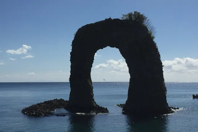
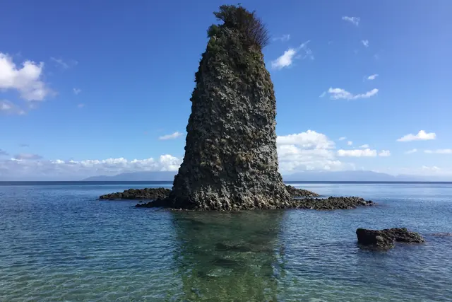
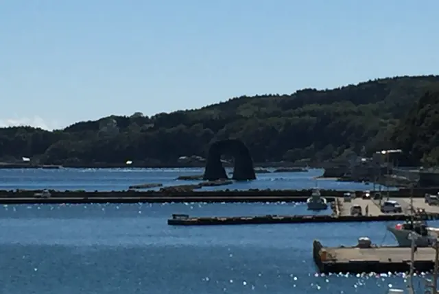
The name. The Hokkaido Tourism Organization explains it: "Nabetsuru Rock is one of the most recognizable landmarks of Okushiri Island, named for its resemblance to the handle (tsuru) of a traditional Japanese cooking pot." Nabe is the pot and iwa is rock, so Nabetsuru-iwa and Nabetsuru Rock are the same place. The tourism association describes the shape as a doughnut.
How it formed. The same page gives the geology in a sentence: "Formed by underwater volcanic activity and shaped over many years by wind and wave erosion, this natural arch stands approximately 19.5 meters high, creating a striking silhouette against the Sea of Japan." The town's own page says much the same: a submarine volcano first, weathering afterwards.
The shrub on top. The plant growing on the crown of the arch is hiroha-no-hebinoborazu. The tourism association explains that its branches and leaves carry thorns, that the name means a plant not even a snake will climb, and that it has small flowers and red berries. The Hokkaido Tourism Organization calls the top of the rock a habitat of this rare plant.
Where to stand. The town has built a viewing deck on the shore, and the Hokkaido Tourism Organization describes the visit: "Visitors can view the rock from a coastal observation point, appreciating its distinctive arch-like shape while listening to the sound of waves along the shore." The hole in the rock shows only from in front. This site's own photographs of the rock were taken in September 2018. One of them was taken side-on, where the two legs line up and the hole disappears, so that the rock looks like a single stack. Another shows it from the harbour, beyond the breakwaters.
Nabetsuru-iwa after dark and in the morning
The rock is lit from 17:00 to 21:00, and from 18:00 to 22:00 in July and August. JNTO puts it lightly: "You will not miss it even at night, when it is illuminated to dramatic effect." The Hokkaido Tourism Organization adds what else may be in view: "At night, illumination highlights the rock's outline, and under favorable conditions it can be viewed alongside the lights of squid-fishing boats on the horizon."
It suggests an early look as well: "In the morning, sunlight illuminates the arch and surrounding sea, offering a different perspective of this iconic coastal landmark."
Both fit the ferry timetable. For most of the year the ship reaches the island at 15:10 and leaves at 7:00 the next morning, so a visitor who stays near the port can walk to the rock in the afternoon, see it lit in the evening and still catch the morning sailing.
On a day trip from Esashi, which is possible only on the days with two sailings, the ship arrives at 11:50 and leaves at 15:00. A second-class passenger has to finish at the counter 30 to 40 minutes before departure, which leaves about two and a half hours ashore: enough for the walk to the rock and back and for lunch near the port.
The Unimaru monument and Unimaru Park
Uni is sea urchin, the catch the island is best known for, and the Unimaru monument is a sea urchin 13 metres high.
- What it is. The tourism association describes a stainless-steel monument modelled on the purple sea urchin caught around the island, with 120 projections for the spines.
- At night. It is lit after dark. The town's page says that it lights up by itself, and the association says that it can be seen together with the lights of the fishing boats at sea.
- Where it is. It stands in Unimaru Park in the Akaishi district, on high ground with a wide view over the Sea of Japan. The town's list of parks dates the park to 1993.
- Getting there. The town puts the park about 5 minutes by car south of the ferry terminal: turn off at the sign for the park entrance on the main road and take the slope that climbs towards Okushiri High School.
- Camping. One of the island's four free campsites is beside the park. It is described in the section on beaches and campsites.
A baseball room and a guided walk
- Sato Yoshinori Baseball Exhibition Room. The town lists it among the sights of the port area, and the tourism association gives it as free and open from 9:00 to 17:00 from May to November. Neither page describes what is on show, so this page does not either.
- The footpath walk. The tourism association runs a guided walk that it lists as free, for one person or more, lasting about 90 minutes or longer, from May to November. Its page presents the walk as a way to see a side of the island other than the sea. The pages read do not say whether the guide speaks English.
The 1993 tsunami and the Okushiri Island Tsunami Museum
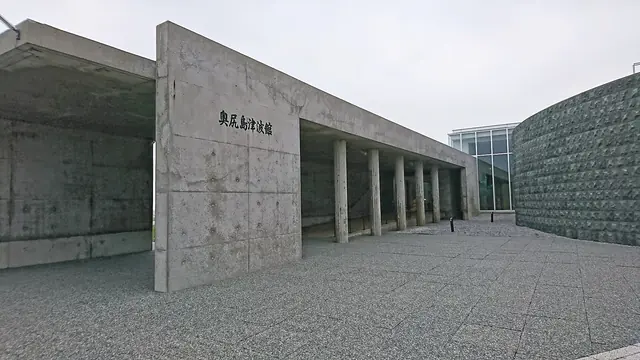
At 22:17 on 12 July 1993 an earthquake of magnitude 7.8 struck beneath the Sea of Japan off south-west Hokkaido, and the tsunami it raised reached Okushiri within minutes. The town counts 198 people dead or missing on the island. The Okushiri Island Tsunami Museum at Aonae, at the southern tip, opened in 2001 to keep the record, and in 2026 it is open from 18 April to 31 October. JNTO's feature on the island states the event plainly: "In 1993, Okushiri was severely damaged by a massive tsunami caused by the Southwest-Off Hokkaido Earthquake." In Japanese the earthquake is called Hokkaido Nansei-oki Jishin.
What happened on the night of 12 July 1993
The figures below are the ones on the Town of Okushiri's pages about the disaster.
| Item | Figure |
|---|---|
| Time | 22:17 on 12 July 1993 |
| Magnitude | 7.8 |
| Depth | 34 km |
| Epicentre | 42°47′ north, 139°12′ east |
| Shaking on Okushiri | Estimated at 6 on Japan's intensity scale; the island had no seismometer |
| Major tsunami warning | Issued at 22:22 by the Sapporo District Meteorological Observatory |
| First wave at Okushiri | Thought to have arrived 2 to 3 minutes after the earthquake |
| Highest run-up | 29 m at Monai on the west coast; the town notes that some put it at 31 m |
The warning came five minutes after the earthquake and the first wave two or three minutes after it. On Okushiri the sea arrived before the warning did.
- The cliff in the Okushiri district. Straight after the shaking a large cliff collapse buried a hotel, a restaurant and a kerosene storage tank. The town records 29 deaths there, among them guests who were staying from outside the island.
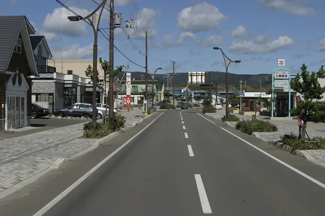
- The tsunami. Inaho at the northern tip, Hatsumatsumae and Aonae at the southern tip and Monai on the west coast were devastated. The town says that most of the lives lost on the island were lost to the tsunami.
- The fires. Two ship fires and one building fire broke out at Aonae, and one vehicle fire in the Okushiri district. The town estimates that the building fire first caught at about 22:35. Its cause was never established, though the town presumes that the earthquake and tsunami set it off. It spread widely and was put out at 9:20 the next morning.
| Loss, in the town's figures | Number |
|---|---|
| Dead | 172 |
| Missing | 26 |
| Seriously injured | 50 |
| Slightly injured | 93 |
| Houses destroyed | 437, the homes of 442 households and 1,242 people |
| Houses half-destroyed | 88 |
| Boats sunk or washed away | 421 |
| Boats damaged | 170 |
| Total damage | 66,420,277 thousand yen, about 66.4 billion yen |
The dead and the missing together make the 198 that the museum's page gives and that the memorial at Cape Aonae carries. The Japan Meteorological Agency's table of damaging earthquakes lists the same earthquake with 202 dead and 28 missing; its count covers the earthquake as a whole, not only the island. The highest intensity it shows as observed is 5.
How the island was rebuilt
JNTO's feature gives the length of the recovery: "It took five years for the island to recover and return to normal life." The town's history page dates its declaration that the recovery was complete to 1998, and its recovery page says that the fund for the work began with 9 billion yen of donations.
Much of what was built is still what a visitor drives past.
- Raised ground behind seawalls. At Aonae, Inaho and Hatsumatsumae the ground was built up behind seawalls made to the height the tsunami had reached, with new roads, drains and evacuation places.
- Houses on the hill. At Cape Aonae the homes were moved together to high ground. The cape itself, which another tsunami had struck ten years earlier, was closed to housing and laid out as parkland. The Aonae district that was washed away is now Tokuyo Memorial Green Park, which the town's list of parks dates to 1996.
- Height markers and evacuation routes. The town says that markers showing how high the water came stand in many places, and that evacuation routes have been laid out.
- A tsunami water gate. The town describes it as the first in Hokkaido.
- Two schools. Inaho's primary school was rebuilt on raised ground, and Aonae's primary school has a ground floor of open pillars.
- The cliff. The slope that collapsed in the Okushiri district was restored, and it now carries a large mural.
JNTO's feature suggests looking at the result from the road: "Enjoy the beautiful coastline and the little fishing towns rebuilt after the tsunami."
The Okushiri Island Tsunami Museum: dates, hours and admission
The town says that the museum was built so that the memory of the disaster would not fade and so that what was learned from it would be handed on. The building was completed on 20 October 2000 and opened in 2001, eight years after the earthquake. It is a concrete building of 1,347.1 square metres on two levels: an entrance hall, an exhibition lounge and a view lounge on the ground floor, and a film hall and an archaeology room below.
The town describes seven themed display spaces that follow the disaster through to the recovery, and its page names these exhibits.
- The memorial plate.
- Photographs of the earthquake, taken at the scene.
- 198 no Hikari, the 198 lights. Stained glass in memory of the people who died.
- Scale models. They run from the formation of the island and its history to the earthquake, the rescue work and the recovery.
- The film. A record of the disaster about 10 minutes long, shown in the hall downstairs. This is the film with an English-subtitled version.
- A magatama. A comma-shaped bead, listed as a cultural property designated by the town.
- The archaeology room. Finds excavated on the island, from the early part of the Jomon period to the Okhotsk and Satsumon cultures.
The 2026 season ends on 31 October. The dates for 2027 were not on the town's page on 12 October 2026, and a visitor who comes between November and the middle of April should expect the museum to be shut.
Getting to the museum by bus
The town bus's southern line stops at the Tsunami Museum on its way to the airport.
| Leave the ferry terminal | Arrive Tsunami Museum | Buses back pass the museum at |
|---|---|---|
| 9:20 | 9:55 | 10:10, 12:46, 14:03, 15:11 and 16:44 |
| 11:00 | 11:35 | 12:46, 14:03, 15:11 and 16:44 |
| 12:30 | 13:12 | 14:03, 15:11 and 16:44 |
| 14:14 | 14:56 | 15:11 and 16:44 |
- The morning bus gives the most time. Arriving at 9:55 and leaving at 12:46 allows nearly three hours for the museum and the monuments at the cape.
- The last bus back passes at 16:44. It reaches the ferry terminal at 17:19.
- A day trip from Esashi does not work by bus. The 12:30 bus reaches the museum at 13:12, and the next bus back reaches the ferry terminal at 14:45, after a second-class passenger should have finished at the counter for the 15:00 sailing.
- The fare is 200 yen each way, in cash, as on every town bus.
Jikusho and the Tokuyo monument at Cape Aonae
Aonae is the base of the island's fishing, and the town describes the cape beyond it as a quiet place. Two monuments stand there.
- Jikusho. A memorial in black granite on a rise in Tokuyo Memorial Green Park. The town explains that the hollow at its centre faces the epicentre to the south-west, and that on 12 July a person standing in front of it and looking out to sea sees the sun set into the hollow. The names of the 198 are on its wall. The tourism association adds that the form stands for heart, sea and wings, that the marks at its base stand for spray, and that stone slabs beside it carry an imperial poem and a poem by Aso Naoko, a poet from the island. The town calls it both a memorial and a place where islanders think about the island's future.
- The Tokuyo monument. A tower 16.7 metres high at the southern tip, built in 1931. The town notes that it withstood the tsunami and calls it the symbol of Cape Aonae.
Both are memorials before they are sights. Keep voices low, and do not climb on them.
A recognised record of the disaster
The museum and the island's group of tsunami storytellers have been certified together as a NIPPON Bosai Shisan, a disaster-prevention asset, under a national scheme set up in May 2024. The certificate and its plaque are displayed in the museum. The town describes the storytellers as people who pass on what they went through, on the spot and in talks. The pages read do not say whether a talk can be arranged in English.
The north: Sai-no-Kawara, Cape Inaho and Mount Tamashima
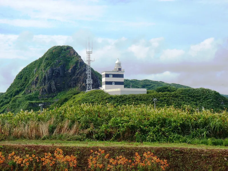
North of the ferry terminal the coast road runs to Cape Inaho, the island's northern tip, where a field of piled stones called Sai-no-Kawara spreads over about 6 hectares beside the Inaho lighthouse. On the way are the sandy beach at Yamasedomari and the shrine of Miyatsu Benten-gu, and a road climbs to the viewing deck on Mount Tamashima, 369.3 metres up. JNTO counts the mountain among the reasons to come: "Explore Okushiri Island's hiking trails, cycle along the breezy coastline, and take in the panoramic view from Mt. Tamashima."
| Place | What it is | On the 9:34 bus from the ferry terminal | By car, on the town's and the association's pages |
|---|---|---|---|
| Yamasedomari | The island's only sandy swimming beach | 9:45 | About 4 km north, about 7 minutes |
| Miyatsu | The district of the shrine Miyatsu Benten-gu | 9:48 | Not given |
| Sai-no-Kawara | A memorial field of piled stones at Cape Inaho | 9:52 | About 10 km north, about 15 minutes |
| Mount Tamashima | A viewing deck at 369.3 m | No bus | About 20 minutes from Okushiri port |
The bus covers more ground than a car does: its route to Sai-no-Kawara is 12.3 km, against the town's figure of about 10 km for drivers.
Sai-no-Kawara and the Inaho lighthouse
The town's page on the Cape Inaho area calls this a place where islanders have prayed since old times. The tourism association gives the detail.
- A memorial ground. The stones are piled for people lost at sea and for children who died young.
- A named sacred site. In 1933 a poll run by a Hakodate newspaper chose it as one of the five sacred sites of southern Hokkaido.
- The lighthouse. The sea around the cape is full of reefs and wrecks were frequent, and the Inaho lighthouse was set up on 1 December 1891.
- Memorial services. They are held on 22 and 23 June.
- After 1993. Inaho was one of the districts the tsunami devastated. A cooking area and toilets were built at the park after the earthquake, and it became one of the island's free campsites.
- Food. There is a shop and eatery at the entrance, where the association says seasonal shellfish such as abalone and whelks are served raw or grilled to order. It gives no prices, so this site does not quote one.
- Season. The association gives May to November as the time to come.
The piles of stones are memorials. Leave them as they are, and walk between them, not over them. At night the park has no lighting at all; the town's campsite page says so, and recommends it for the stars for that reason.
Miyatsu Benten-gu
The tourism association says that a guard post once stood on this spot: it was the island's point of contact with the opposite shore, and a watch was kept from it for convicts trying to escape. In 1831 the islanders dedicated a figure of Benten here to pray for good catches. The association's page adds a piece of island lore: Benten is said to give a calm crossing home to visitors she takes a liking to. Its season for the shrine is May to November.
Mount Tamashima: the view over the north of the island
- Height. 369.3 metres.
- The view. The tourism association describes a wide panorama from the centre of the island across the whole northern side. On clear days the islands of Oshima and Kojima off Matsumae can be made out.
- The last stretch. About 90 steps lead from the car park to the viewing deck on the summit.
- Autumn. The association describes the island's beech woods turning orange below the deck.
- At night. It recommends the summit for stars and, in the squid season, for the lights of the fishing boats, and tells night visitors to bring a torch, warm clothes and insect repellent.
- Getting there. About 20 minutes by car from Okushiri port. The association states that there is no route bus, so the choice is a rental car or a taxi.
- Season. May to November.
The north by bus
The northern line runs from the ferry terminal to Nonamae, three kilometres or so beyond Sai-no-Kawara, five times a day.
- A short visit. Leave the ferry terminal at 9:34 and reach Sai-no-Kawara at 9:52. The same bus comes back past the stop at 10:05 and is at the ferry terminal at 10:23.
- A longer morning. Take the 9:34 out and the 12:53 back, which reaches the ferry terminal at 13:11. That is three hours at the cape.
- An afternoon. Leave at 12:22 and arrive at 12:40. The last bus back passes at 16:18 and reaches the ferry terminal at 16:36.
- Stopping on the way. The town bus picks up and sets down anywhere along its route where it is safe to stop, so Yamasedomari or Miyatsu can be combined with the cape. The times of the buses back at those two places are on the town's timetable.
The west coast: Kamuiwaki Onsen, Cape Kitaoi and the sea stacks
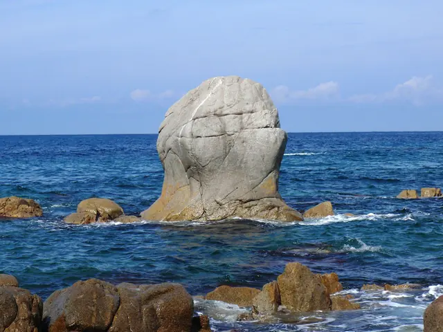
The west coast faces the open Sea of Japan and the sunset. The town's page on the Kamuiwaki area describes its scenery as the most rugged on the island and lists three of its rocks, Hoya-ishi, Kabuto-iwa and Muen-jima, together with a hot spring. JNTO's page on the island notes that "The island is known for its interesting rock formations along the shoreline", and this is the coast where the tourism association lists four of them.
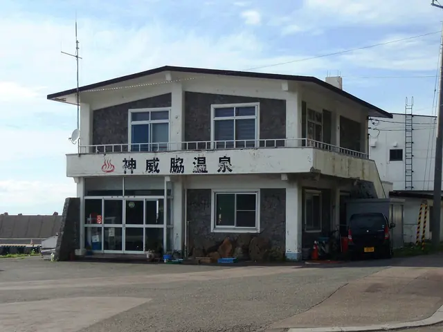
Kamuiwaki Onsen: hours, charges and what to bring
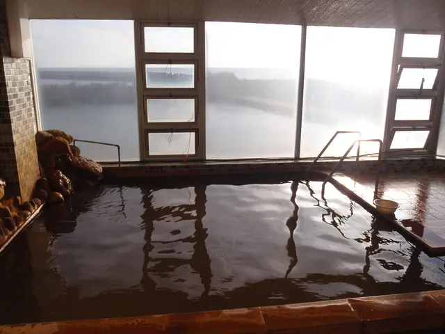
- The water. The town says that water at about 65°C is pumped from 30 metres underground at 300 litres a minute, and that it runs through the baths straight from the source. Cold water may be added in hot weather.
- What the charge includes. The adult charge includes a bathing tax of 70 yen. How that tax works is on the accommodation tax page.
- What to bring. Nothing is laid out in the washing area. Shampoo, conditioner, body soap and towels are sold at reception, and bath towels can be hired.
- A place to sit. There is a rest room for bathers.
- How to bathe. The steps are the same as at any shared bath in Japan, and they are set out in the etiquette section of the ryokan guide.
- Tattoos. The town's page says nothing about them, so this page does not either.
JNTO pictures an evening here: "Enjoy sea kayaking and snorkeling in the clear blue waters in summer, or watch the sun go down while relaxing at Kamuiwaki Onsen, Hokkaido's westernmost hot spring." The bathhouse does stay open until 20:00, but the bus does not allow it.
Kamuiwaki Onsen by bus and by car
- One bus fits. The 11:00 bus from the ferry terminal runs through by way of Aonae and the airport and reaches Kamuiwaki Onsen at 11:58. The last passenger bus back leaves at 13:39 and is at the ferry terminal at 14:45. That gives about one hour and 40 minutes at the hot spring.
- The earlier buses arrive before it opens. They reach the hot spring at 6:58 and 8:01.
- The 12:30 is too late. It arrives at 13:35, four minutes before the last bus back.
- By car. The town's campsite page gives Cape Kitaoi, about 500 metres from the hot spring, as about 15 km and 25 minutes from the ferry terminal by way of Horonai, and about 33 km and 45 minutes by way of Aonae.
- For the sunset. With no bus after 13:39, an evening bath means a rental car, a taxi, a tent at Cape Kitaoi, or a night in Yunohama, the district around the cape, where the tourism association lists one place to stay.
Cape Kitaoi and its sculptures
Kitaoi-misaki Park is one stop before the hot spring on the west-coast bus, 12.5 km from the airport. The town's list of parks dates it to 1981.
- The sculptures. The tourism association lists eight stone works by the sculptor Nagare Masayuki in the park, the first of them named after the cape itself.
- Why they are here. The association records that people who had been driven from Kunashiri Island settled at Kamuiwaki in 1946, and that their longing for home, which it calls the wish of the whole island, moved the sculptor to make that first work.
- The marker. The town's campsite page mentions a post marking the cape as the westernmost point of Hokkaido, which it calls a spot for photographs.
- Walking and camping. There is a walking path, and the tip of the cape is one of the four free campsites. The town warns that it catches the wind.
- Sunset and stars. The town describes a wide view with the sunset in it. The association notes that much of the island has no street lighting and names the park as one of the places for a starry sky on a clear night.
Muen-jima, Hoya-ishi and the other rocks
| Rock | What the town and the tourism association say | Bus stop on the west-coast line |
|---|---|---|
| Muen-jima | An islet that looks, from some angles, like a monk praying with beads in his hands | Muen-jima coast, 5.9 km from the airport |
| Hoya-ishi | 25 m high, named after the sea squirt, and from the side like a stack of firewood | Hoya-ishi coast, 6.9 km from the airport |
| Kabuto-iwa | Named for its likeness to a warrior's helmet; half of it fell in the 1993 earthquake | None listed |
| Mottate-iwa | A sea stack whose name, the association says, is best asked about on the island | None listed |
The legend of Muen-jima. The town's page tells it. A girl from Kamuiwaki named Utako fell in love with Seijiro, a man who had drifted in from Noto, and he betrayed her. After her death a monk called Muen came to the island, prayed for her at length and crossed to another islet to fast and meditate. Some days later a rough sea carried him away, and he was washed ashore, still gripping his prayer beads, on the islet that came to bear his name. The legend says that the monk was Seijiro, who had come to regret what he did. The association adds that anglers use the spot from spring to summer and swimmers in summer, and that the sunsets are best from spring to autumn.
The Hoya-ishi waterfall. A waterfall drops close to the rock. The town says that the island's forest feeds several rivers and falls, that this river is used for hydro power and that the spot is cool even in midsummer. The water runs all year, and the association notes that it freezes into a sculpture of ice around January and February.
Horonai and the tsunami on this coast
Horonai is north of Kamuiwaki, on the road that crosses back to the ferry port, and no bus goes there. The tourism association describes an untouched rocky shore with clear water, suited to kayaking and stand-up paddleboarding, with a season from May to October.
The highest point the 1993 tsunami reached was on this coast: 29 metres at Monai, in the town's account. None of the pages read marks a spot to visit there, and this page does not suggest one.
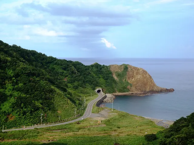
Beaches, kayaking and free campsites
Okushiri has three official swimming places, two operators who take visitors out in sea kayaks and on stand-up paddleboards, and four campsites that charge nothing. The tourism association gives July to September for swimming and roughly the end of April to October for paddling, and the town opens its campsites from late April to the end of October. JNTO's feature on hiking and kayaking here sums up the appeal: "Enjoy adventures with a unique flavor on Hokkaido's westernmost island."
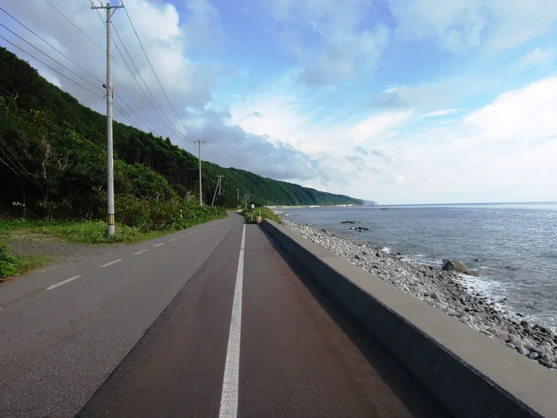
Swimming: three official places, July to September
- Three places, one of them named. The town says the island has three official swimming places (kaisuiyoku tekichi), chosen for their wide sands or gently shelving shores. Its leisure page names only one of them, the beach at Yamasedomari.
- Yamasedomari has the facilities. The town calls it the popular one and lists changing rooms, showers and toilets. Its campsite page adds that this is the island's only swimming place with a sandy beach and that it is busy with families.
- Sai-no-Kawara. The same campsite page says that swimming, paddling and fishing are possible at the park on Cape Inaho.
- How clear the sea is. The town says the water is clear to a depth of 25 metres.
- The season. The tourism association lists swimming from July to September and offers to recommend a spot to anyone who asks.
- Lifeguards. None of the pages read says whether a beach is watched by lifeguards, or on which dates, so this page does not say either.
Yamasedomari is about 4 km north of the ferry terminal, or about 7 minutes by car, on the town's figures; the bus route to the stop of the same name measures 6.1 km. The northern bus line gets there in 11 minutes.
| Direction | Bus times |
|---|---|
| Ferry terminal to Yamasedomari | 9:34 → 9:45, 12:22 → 12:33, 15:47 → 15:58 |
| Yamasedomari to the ferry terminal | 10:12 → 10:23, 13:00 → 13:11, 16:25 → 16:36 |
An earlier bus leaves the terminal at 8:05, and another at 7:02 on school days only; the full table is in the section on getting around. Going out on the 9:34 and coming back on the 13:00 leaves a little over three hours at the beach, and the 16:25 leaves more than six. These are the times of the timetable that began on 1 October 2026. The town's page does not say whether it will change before next summer, so check it again before a July trip.
Sea kayaking, paddleboarding and other sessions
The tourism association's activity page lists two operators for sessions on sea kayaks and stand-up paddleboards. This page does not name businesses, so the table gives only what each listing says.
| Listing | Season | Price | Group | Length |
|---|---|---|---|---|
| One operator | May to October | From 6,000 yen | From 1 person | About 60 minutes or more |
| The other operator | End of April to mid-October | From 5,500 yen | From 1 person | About 60 minutes or more |
- Where. The association describes Horonai, on the west coast north of Kamuiwaki, as the stretch suited to kayaks and paddleboards; it is covered in the west-coast section above.
- What else the town mentions. The town's leisure page also names windsurfing and water-skiing. The sessions on the association's list are for kayaks and paddleboards.
- Fishing. The association lists fishing with rented tackle, without further details on the page read.
- Craft sessions. These are listed all year, from 2,750 yen for about 60 minutes and from 3,500 yen for about 120 minutes, which makes them the wet-day and winter option.
- The free return ticket. The campaign described in the fares section asks for one experience programme as well as a night's stay, and only programmes on the campaign's own list count. Check that list before booking a session for that purpose.
- The prices. The starting prices are the association's, read on 12 October 2026. The page does not say what a longer session costs, so this site does not quote one.
Four free campsites
The town lists four campsites. All four are free, none has a manager on site, none rents equipment, and all are open from late April to the end of October.
| Campsite | District | From the ferry terminal | Car camping | Free parking |
|---|---|---|---|---|
| Unimaru campsite (NONA BASE) | Akaishi | About 5 minutes by car, to the south | Allowed, but keep the car off the pitch when rain would damage the grass | About 20 cars |
| Sai-no-Kawara Park | Inaho | About 10 km north, about 15 minutes by car | In the car park only | About 60 cars |
| Kitaoi-misaki Park | Yunohama | About 15 km and 25 minutes by way of Horonai, or about 33 km and 45 minutes by way of Aonae | If there is space, first come first served | About 3 cars |
| Yamasedomari beach | Tamaura | About 4 km north, about 7 minutes by car | Not allowed | About 30 cars |
What each site has, in the town's descriptions:
| Campsite | Toilets | Cooking | Ground | Worth knowing |
|---|---|---|---|---|
| Unimaru campsite (NONA BASE) | A temporary flush toilet | A roofed, lit cooking area; the tap water is not for drinking | Grass beyond the fence, with parking in front of it | On high ground with a view over the Sea of Japan; the Unimaru monument on the grounds is lit at night |
| Sai-no-Kawara Park | Two flush-toilet blocks, including a wheelchair-accessible toilet | A cooking hut with hearths, and outdoor hearths | Earth only; pitching on the grass is forbidden in principle | No lighting at night; a sports ground; an eatery and souvenir shop at the entrance |
| Kitaoi-misaki Park | One flush-toilet block, and another at the park entrance | One cooking hut, and another on the grass along the approach | Natural grass, with some earth | The town-run hot spring is about 500 m away; the tip of the cape is exposed to the wind |
| Yamasedomari beach | One flush-toilet block, with showers | One cooking hut | Sand | A rest room that is not for sleeping in; houses stand nearby |
The rules the town sets for all four:
- Take your rubbish home. A bin for visitors opposite the Okushiri ferry terminal takes rubbish in the town's designated bags, which shops and souvenir shops sell: blue for burnable rubbish and red for non-burnable.
- No fire on the bare ground. Leftover charcoal and ash go to the designated place.
- Quiet after 21:00. No loud voices, loud music or fireworks.
- No selling. Nothing may be sold without permission.
- At your own risk. The town accepts no responsibility for accidents, disputes or theft.
- Bring everything. Nothing is rented at the sites, and the water at the Unimaru site is not for drinking.
Sai-no-Kawara after dark. The town warns that the site has no lighting and is pitch dark at night, and adds that this is what makes it good for stars. The northern bus line stops at the park; the times are in the section on the north.
Kitaoi-misaki and the bath. The bathhouse about 500 m away is the reason most campers would choose this site, and its hours and charges are in the west-coast section. Because the tip of the cape catches the wind, the town notes that some campers pitch on the grass along the approach road instead.
Yamasedomari and its neighbours. Houses stand close to the beach, so the town strictly forbids karaoke and fireworks there. The same page says the district has a shop and three guesthouses.
Tent and ferry. A car space on the ferry can be booked from two months ahead. A motorbike or a bicycle cannot be booked and has to be at the counter an hour before departure, as the booking section explains.
Nagahama: eight kilometres of granite shore
- The name. Nagahama means long beach, and the tourism association gives its length as 8 km.
- Granite. The association says the shore is granite throughout and is also called the granite coast. Islanders call the stone goma-ishi and use it to weigh down pickles.
- In summer. The association describes white granite against clear water.
- In winter. Steller's sea eagles and white-tailed eagles, both natural monuments, fly in from the north and can be seen resting here, on the association's account.
- Season. The association lists it as a place for every season.
- By bus. The southern line has a stop named Nagahama: 9:39 on the 9:20 bus from the ferry terminal and 11:19 on the 11:00. The timetable does not say how far the stop is from the shore, so this page does not either.
The July festival
Three older festivals were abolished and replaced, from 2024, by a single event, Okushiri Marugoto Matsuri, which the town describes as the island's largest. It brings together the island's food and industries, with events that visitors can join. It was held on 13 and 14 July in 2024, at a special venue at Okushiri port, and on 12 and 13 July in 2025, a Saturday and Sunday both times. Neither the town's page nor the tourism association's gives the 2026 date or one for 2027, so this page does not guess.
What to eat on Okushiri Island
Sea urchin and abalone, above all. In the words of JNTO's page on the island, "The waters off Okushiri Island are famous for abalone and sea urchin", and the town's own list of local dishes starts with sea urchin on rice. The town says the sea-urchin fishery falls in summer, when most visitors come. None of the pages read gives a price, and this page names no restaurants.
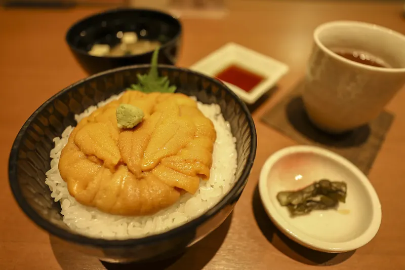
Sea urchin and abalone
- Sea urchin on rice. Uni-don is raw sea urchin on a bowl of rice. The town calls it the most popular of the island's dishes and recommends it with the sea urchin piled on generously.
- Summer is the season. The town ties the dish to the summer fishery. None of the pages read says whether fresh sea urchin is served in other months, so ask before travelling for it in spring, autumn or winter.
- Abalone. The town's list has abalone jigoku-yaki, which translates word for word as hell-grilled, and an abalone boxed lunch.
- Both in one bowl. JNTO's advice is specific: "Make sure to try one of the island's signature seasonal dishes, a bowl of fresh abalone and sea urchin on rice."
- The photograph here. The bowl pictured in this section was photographed in Sapporo, not on the island. It is here to show what uni-don looks like.
- This site's own visit. On this site's own visit in September 2018 the meals were mostly seafood, and sea urchin and abalone were among them. That is a single visit, so it is no guide to what is served in other months or years.
The town's list of dishes
| Name on the town's list | In English |
|---|---|
| Uni-don | Sea urchin on rice |
| Uni ruibe-don | Sea urchin ruibe on rice; ruibe is the Hokkaido word for seafood eaten frozen |
| Uni ichiya-zuke | Sea urchin pickled overnight |
| Uni nabe | Sea-urchin hotpot |
| Awabi no jigoku-yaki | Hell-grilled abalone |
| Awabi bento | An abalone boxed lunch |
| Sanpei-jiru | A soup of salted fish and vegetables, described below |
| Hokke no shabu-shabu | Atka mackerel shabu-shabu |
| Hokke no izushi | Atka mackerel izushi, a preserve of fish fermented with rice |
| Ika no shiokara | Salted squid |
| Okushiri wagyu | Okushiri wagyu beef |
| Kitobiro | Alpine leek, a wild green, under its Hokkaido name |
The town's page gives the names and three photographs, not descriptions. The right-hand column therefore translates the names and glosses the food words in them; it does not describe how each dish is served on the island.
Sanpei-jiru: the soup the town claims
- What it is. A soup of salt-preserved fish and vegetables, seasoned by the salt in the fish. The town calls it a traditional dish of Okushiri and of the Hiyama region.
- In the old records. The town cites records from the Edo period in which herring, sandfish, cod and flounder were salted whole and vegetables were simmered in the liquid.
- How it changed. The smell of that liquid, the town says, led cooks to use the flesh of the fish instead.
- An everyday supper. Around 1945 it was an ordinary evening meal in the fishing villages of Hiyama, thick with potatoes.
- The fish. The dish is said to have begun with herring or salmon. On Okushiri today it is made with Atka mackerel or cod.
- The vegetables. Daikon radish, potato, carrot and onion. The recipe varies by district and by household.
- The claim. The town heads its page with the claim that Okushiri is where the dish began. This page reports the claim and does not judge it.
The rest of the catch
Hokkaido's tourism organisation lists the main names: "With a thriving fishing industry, the island offers fresh seafood, including uni (sea urchin), abalone, squid, and Atka mackerel." The town's page adds flounder and other flatfish, trout, rockfish, shrimp and cod, whelks and other shellfish, and seaweed such as laver, with winter laver gathered in the cold months.
Where to eat, and what it costs
- Restaurants. None of the pages read for this guide ranks or recommends places to eat, and this page names none. The tourism association's office in the Okushiri district is the place to ask.
- Prices. No page read gives the price of a sea-urchin bowl or of any other dish, so this site does not quote one.
- At Sai-no-Kawara. The town's campsite page mentions an eatery and souvenir shop at the entrance to the park.
- On the ferry. The ship has no restaurant and its shop is closed, so eat before boarding or carry something.
- At the lodging. The association's lodging list says nothing about meals, so ask about dinner and breakfast when booking.
Where to stay
The tourism association's lodging page listed 14 places to stay on 12 October 2026. Seven have minshuku, the word for a family-run guesthouse, in their names, two are ryokan, one calls itself a guesthouse, and none calls itself a hotel. Four are in the Okushiri district by the ferry port and four in Aonae in the south. The page gives no prices. The town's own lodging page simply points to the association.
| District | Places listed | Where it is |
|---|---|---|
| Okushiri | 4 | Around the ferry port |
| Aonae | 4 | The southern tip, the district of the tsunami museum |
| Miyatsu | 2 | On the northern bus line, 8.1 km from the ferry terminal by the bus route |
| Inaho | 1 | The northern tip, the district of Sai-no-Kawara |
| Tamaura | 1 | The district of Yamasedomari beach |
| Yunohama | 1 | The west coast, the district of Cape Kitaoi |
| Yoneoka | 1 | The entry gives no details |
The page's area filter also has Akaishi, with no entry under it. This page does not name the lodgings; the list below is what the association's entries say, taken together.
- Size. Thirteen of the 14 entries give details. Twelve state a capacity, from 10 to 40 guests, and one gives 6 rooms instead.
- Parking. All 13 list parking.
- Wi-Fi. Twelve say yes and one says no.
- Closed days. Five say none and eight say irregular.
- What is missing. The page gives no prices, nothing about meals and nothing about online booking. Each entry has a telephone number, which this page does not repeat.
- A different count. The town's campsite page mentions three guesthouses in the district around Yamasedomari beach, while the association lists one place under Tamaura. This page does not try to reconcile the two.
Choosing where to sleep
- The last night near the port. No town bus reaches the morning ferry, which leaves at 07:00 for most of the year. A bed in the Okushiri district, or a taxi booked the day before, solves that.
- Aonae for the museum. Four listed places are in the district of the tsunami museum and the memorials at the southern tip.
- The hot spring. The bathhouse at Kamuiwaki has no rooms. The association lists one place in Yunohama, the district around Cape Kitaoi.
- The free return ticket. The campaign needs a night at a lodging on its own list, so check the list before booking.
- July and August. These are the months with two ferries a day, the swimming season and the festival, and the places on the list are small. Settle the room before buying anything else.
- How an inn works. Shoes, shared baths and set mealtimes are explained in this site's ryokan guide.
- The night before the ferry. The first sailing of the day to the island leaves Esashi at 09:40 or 13:00, depending on the season. For a night in Hakodate before or after, see the hotel guide.
- This site's own visit. This site's own visit in September 2018 included a stay at a ryokan. This page does not name it, as it names no lodging.
Best time to visit Okushiri Island
July and August give the widest choice. The ferry makes two round trips a day, the sea is open for swimming, sea urchin is in season, the tsunami museum opens every day, and the island is at its warmest and least windy. May, June, September and October are quieter and cooler, with the museum and the campsites still open. From November to March the museum and the campsites are shut, the ferry crossing is longer from December, and from December to February the wind is about twice as strong as in summer.
The figures below are the Japan Meteorological Agency's averages for its Okushiri station, for the years 2000 to 2020.
| Month | Mean temperature | Daily maximum | Daily minimum | Precipitation | Mean wind speed | Sunshine |
|---|---|---|---|---|---|---|
| January | -0.4°C | 1.6°C | -2.4°C | 29.6 mm | 8.8 m/s | 45.2 hours |
| February | -0.2°C | 1.9°C | -2.2°C | 34.1 mm | 8.3 m/s | 71.3 hours |
| March | 3.0°C | 5.3°C | 0.7°C | 42.4 mm | 7.4 m/s | 158.2 hours |
| April | 7.4°C | 10.0°C | 5.0°C | 64.2 mm | 6.1 m/s | 207.9 hours |
| May | 11.7°C | 14.6°C | 9.3°C | 83.8 mm | 5.3 m/s | 196.2 hours |
| June | 16.0°C | 19.0°C | 13.6°C | 76.3 mm | 4.3 m/s | 178.4 hours |
| July | 20.1°C | 22.9°C | 17.9°C | 113.3 mm | 4.2 m/s | 154.3 hours |
| August | 22.5°C | 25.4°C | 20.1°C | 127.1 mm | 4.2 m/s | 199.1 hours |
| September | 20.0°C | 22.6°C | 17.5°C | 122.7 mm | 5.1 m/s | 189.1 hours |
| October | 14.2°C | 16.6°C | 11.8°C | 90.4 mm | 6.3 m/s | 160.6 hours |
| November | 7.6°C | 10.0°C | 5.1°C | 84.2 mm | 7.6 m/s | 87.0 hours |
| December | 1.7°C | 3.9°C | -0.5°C | 61.9 mm | 8.9 m/s | 46.3 hours |
| Year | 10.3°C | 12.8°C | 8.0°C | 920.1 mm | 6.4 m/s | 1,698.2 hours |
- August is the warmest month. The mean is 22.5°C and the average daily maximum 25.4°C.
- January is the coldest. The mean is minus 0.4°C and the average daily minimum minus 2.4°C.
- Summer is the calm season. The mean wind speed is 4.2 m/s in July and August and 8.8 to 8.9 m/s in December and January.
- April is the sunniest month. It averages 207.9 hours of sunshine. January has 45.2.
- August is the wettest month. It averages 127.1 mm, against 29.6 mm in January.
- No snow figures. The agency's table for this station has no snowfall or snow-depth columns, so this page gives none.
Okushiri month by month
The ferry dates in this table are those of the 2026 timetable. The operator had not published the 2027 timetable on 12 October 2026.
| Months | Ferry round trips a day | What is open |
|---|---|---|
| January to March | One, with a crossing of 2 hours 20 minutes | The hot spring. The museum and the campsites are closed |
| April | One, and two from 25 April | The museum from 18 April, the campsites and one of the kayak operators from late April |
| May and June | Two until 6 May, then one | The museum, the campsites, kayak and paddleboard sessions, the guided footpath walk, Mount Tamashima |
| July and August | Two | Everything, with swimming, the sea-urchin season and the museum open every day; the festival fell in mid-July in 2024 and 2025 |
| September | One, and two on the 5th, 6th, 12th, 13th and 19th to 23rd | Everything; the association's swimming season runs to September |
| October | One | The museum until 31 October, the campsites until the end of the month, kayak and paddleboard sessions into October |
| November | One | The hot spring. The association's season for Mount Tamashima, Sai-no-Kawara and Miyatsu Benten-gu ends in November |
| December | One, with a crossing of 2 hours 20 minutes | The hot spring, except from 31 December to 2 January |
- For two ferries a day. Go between 25 April and 6 May, in July or August, or on the September days in the table. Only on those days does a day trip from Esashi work.
- For the museum. Go between 18 April and 31 October, and avoid Mondays outside July and August unless the Monday is a public holiday.
- For the sea. July to September for swimming; May to October for a kayak or a paddleboard.
- For walking. The association gives May to November for the footpath walk and for Mount Tamashima, and mentions autumn colour on the mountain without naming a month.
- For a quiet island. After 6 May, and in June and October, there is one ferry a day, and the museum and the campsites are still open.
- Flights. The airline's schedule changes with the season as well, and the dates in force are in the flights section.
Okushiri Island in winter
Okushiri can be visited in winter, but it is a different trip. The ferry sails once a day each way and takes ten minutes longer, the tsunami museum and the campsites are closed, and the wind averages 8 to 9 metres a second from December to February. In exchange there is a flight from Hakodate every day from 1 December 2026 to 28 February 2027, and the hot spring on the west coast stays open.
| What | From December to March |
|---|---|
| Ferry | One round trip a day. It leaves Okushiri at 07:30 in December and at 08:15 from January to March, and leaves Esashi at 13:00. The crossing takes 2 hours 20 minutes |
| Boarding at Esashi | From the new north pier, with a free shuttle from the terminal planned until 28 February 2027 |
| Flights from Hakodate | Every day from 1 December 2026 to 28 February 2027: Hakodate 11:20, Okushiri 11:50; Okushiri 12:20, Hakodate 12:50 |
| Flights from Sapporo Okadama | Suspended from 1 December 2026 |
| Town bus | Running, except from 31 December to 2 January |
| Tsunami museum | Closed. The 2026 season ends on 31 October |
| Campsites | Closed. They open from late April to the end of October |
| Kamuiwaki Onsen | Open from 11:00 to 20:00; closed on the first Monday of the month and from 31 December to 2 January |
| Tourism association office | Weekdays only, from November to April |
| Nabetsuru-iwa | Lit from 17:00 to 21:00 |
What winter is like in numbers
- Temperature. January averages minus 0.4°C, with a daily maximum of 1.6°C and a daily minimum of minus 2.4°C. February is almost the same.
- Wind. The mean wind speed is 8.9 m/s in December, 8.8 m/s in January and 8.3 m/s in February, about twice the 4.2 m/s of July and August.
- Light. January averages 45.2 hours of sunshine in the whole month and December 46.3, against 199.1 in August.
- Snow. The agency's table for the island has no snow figures, and none of the other pages read gives one.
What there is to see
- The frozen waterfall. The tourism association says the Hoya-ishi waterfall on the west coast freezes into a sculpture of ice around January and February.
- Eagles at Nagahama. Steller's sea eagles and white-tailed eagles come down from the north and rest on the granite shore, on the association's account.
- Nabetsuru-iwa. The association lists the rock as a sight for every season, and it is lit in the evening.
- The bath. Kamuiwaki Onsen opens at 11:00 in winter. The through bus from the ferry terminal arrives at 11:58, and the last bus back leaves at 13:39.
- Winter laver. The town names it as the seaweed of the cold months.
- Indoors. The craft sessions on the association's list run all year.
The ferry and the weather
- One sailing a day. A cancelled sailing costs a whole day, in either direction. The booking section explains how and when the operator announces a cancellation.
- No figure for how often. Neither the operator nor the town says, on the pages read, how many sailings are cancelled in a winter, so this page gives no figure.
- Leave spare days. Do not plan an international flight for the day after the crossing. A night in Hakodate on the way out is the simplest margin.
- Or fly. The daily winter flight from Hakodate takes about 30 minutes. None of the pages read says how often the flight is cancelled.
- March. The published flight schedule ends on 28 February 2027, and the ferry's 2027 timetable was not out on 12 October 2026. Both need checking for a trip in March.
- Roads. None of the pages read says which of the island's roads close in winter, so ask the rental firm or the lodging before driving to the west coast or to Mount Tamashima. The winter section of this site's driving guide covers winter tyres, chains and speeds on ice.
Okushiri Island's population and daily life
The town counted 2,020 residents, 1,077 men and 943 women, in 1,294 households on 30 September 2026. It posts a new figure each month. None of the pages read gives an earlier figure to compare it with, so this page does not describe a trend. Hokkaido's tourism organisation gives the long view: "People have lived on the island for about 8,000 years."
A short history
| When | What happened |
|---|---|
| About 8,000 years ago | People move to the island in the early part of the Jomon period; the town says many sites and finds survive |
| About 500 years ago | Takeda Nobuhiro, crossing from Honshu, is driven ashore by a storm and lives here for a time, in the tourism association's account |
| 1720 | The name Okushiri appears in writing for the first time, in a book by the scholar Arai Hakuseki |
| 1767 | Taguchi Kyubei settles to fish, after which permanent settlers are said to have increased |
| 1869 | The whole island becomes Okushiri district; four villages, Tsurikake, Akaishi, Yakushi and Aonae, are set up afterwards |
| 1879 | A village head's office is established |
| 1906 | The four villages merge into Okushiri village |
| 1966 | Okushiri becomes a town |
| 1967 | The ferry service begins |
| 1993 | The earthquake and tsunami of 12 July |
| 1998 | The town declares the recovery complete in March |
How the island earns its living
- Fishing first. The town says fishing has been the island's mainstay since early times, and that Okushiri was once called an island of dreams and an island of treasure for its catch.
- From herring to squid. Herring was the main catch until the end of the Meiji era, which closed in 1912. Today it is coastal fishing for squid and Atka mackerel, and shore fishing for sea urchin and abalone.
- Fishing and tourism. The town names these two as the industries it puts its effort into.
- Land. The town's breakdown of land use is in the table below. The forest and the rice paddies are described at the top of this page.
| Land use | Share of the island |
|---|---|
| Forest | 71.4% |
| Wilderness | 19.6% |
| Pasture | 2.9% |
| Fields | 2.0% |
| Rice paddies | 1.0% |
| Miscellaneous | 0.6% |
| Residential | 0.5% |
| Other | 2.0% |
The town's tree is the yew, called onko in Hokkaido, and its flower is the hamanasu, a wild rose of the seashore.
Practical points
- Where the shops are. The town says the area around the ferry terminal has the public offices and the shops.
- Cash. The town bus takes cash only. None of the pages read says where the island's cash machines are or which cards its shops and lodgings take, so draw yen before the ferry. This site's ATM guide explains which machines in Japan accept foreign cards.
- Rubbish. Visitors' rubbish goes in the town's designated bags, sold at shops, and into the bin opposite the ferry terminal.
- Getting about. With 11 bus runs a day and none to the morning ferry, a plan without a car depends on the timetable in the section on getting around.
- Asking for help. The tourism association's office in the Okushiri district is open from 9:00 to 17:00. None of the pages read says which languages are spoken there.
Dates on this page that will go out of date
Almost every timetable and price on this page carries a date, and several of them run out within months. The list below puts them in one place, with what each official page said and what it did not say. This is where things stood on 12 October 2026.
- The ferry timetable. The published timetable runs to 31 December 2026. It was announced in a notice dated 31 October 2025, and the 2027 timetable was not on the operator's site on 12 October 2026.
- Ferry fares. The fares on this page are those for 1 October to 31 December 2026, with a fuel surcharge of 0 yen. The surcharge is reviewed every three months. The operator's notice of 24 July 2026 says the figure for January to March 2027 will be announced in October 2026, and it was not on the fare page on 12 October.
- The boarding place at Esashi. Since 1 October 2026 the ship has used the new north pier, with a free shuttle bus from the terminal, and the operator plans to keep this arrangement until 28 February 2027. The published shuttle times cover 1 October to 31 December 2026. The operator says the 2027 times will be announced once the 2027 sailing schedule is decided.
- The car park at Esashi. The operator warns that the free car park at the Esashi terminal may be unusable until about 31 March 2028 because of the quay works.
- Flights. The town's table was last updated on 18 September 2026 and covers 24 September 2026 to 28 February 2027. The Sapporo Okadama route is suspended from 1 December 2026, and the table gives no date for its return. Nothing had been published for the days after 28 February 2027.
- The town bus. The timetable on this page came into force on 1 October 2026, when the town reorganised its bus lines. The town's page does not say whether it will change before next summer.
- Buses between Hakodate and Esashi. Hakodate Bus changed to its winter timetable on 1 October 2026. This page gives journey times and fares only, and the fare table for the Kikonai route is marked as revised on 22 November 2024.
- The tsunami museum. The 2026 season runs from 18 April to 31 October. The dates for 2027 were not on the town's page on 12 October 2026.
- The free return ticket. The campaign for fiscal 2026 began on 17 April 2026 and is limited to 1,000 people. Its page gives neither a closing date nor the number of places left.
- Population. The figure of 2,020 residents is the one for 30 September 2026. The town posts a new figure each month.
- Places to stay. The tourism association listed 14 on 12 October 2026.
- Activity prices. The starting prices for kayaking, paddleboarding and craft sessions were read on 12 October 2026.
- The July festival. The dates on this page are those of 2024 and 2025. No later date is given on the pages read.
- The sightseeing taxi. The details on the tourism association's page are those for 2025.
- This site's photographs and its own visit. This site's own photographs of the ship, the port and Nabetsuru-iwa were taken in September 2018, when the hull carried the words Heart Land Ferry. The first-hand lines on this page come from that same visit: the crossing on the ferry from Esashi, a stay at a ryokan, and meals of seafood with sea urchin and abalone. Everything else, including every timetable, fare and price, is from the 2026 pages listed in the sources.
The sources at the foot of this page link to the pages where each of these is updated. For the ferry, the page to open on the morning of travel is the operator's operation-status page, which carries the day's decision on each sailing.
Frequently asked questions
Where is Okushiri Island?
Okushiri Island is in the Sea of Japan off the south-west corner of Hokkaido, 61 km north-west of Esashi and 42 km south-west of Setana. The whole island is one town of about 2,000 people.
How big is Okushiri Island?
The island measures 27 km from north to south and 11 km from east to west, with an area of 142.99 square kilometres and a coastline of 84 km. Its highest point is Mount Kamui, at 584.5 metres.
How do I get to Okushiri Island?
By car ferry from Esashi or by plane. The ferry takes 2 hours 10 minutes, or 2 hours 20 minutes from December to March. Flights from Hakodate Airport take about 30 minutes. Flights from Sapporo Okadama take about 50 minutes and are suspended from 1 December 2026. Only the ferry carries cars.
How do I get from Hakodate to Esashi?
Hakodate Bus route 610 takes about 2 hours 15 minutes and costs 2,500 yen. Route 631 from Kikonai Station takes about 1 hour 30 minutes and costs 1,900 yen. By car on Route 227 the drive from Hakodate takes about 1 hour 17 minutes. The bus stop for the ferry is Ubagami-cho Ferry-mae, a few minutes on foot from the terminal.
How long is the ferry to Okushiri and how much does it cost?
The crossing from Esashi takes 2 hours 10 minutes from April to November and 2 hours 20 minutes from December to March. From 1 October to 31 December 2026 a one-way ticket costs 3,490 yen in second class, 4,150 yen for a reserved seat and 6,420 yen for an Island View Seat, tax included. Primary-school pupils pay half.
How often does the Okushiri ferry run?
Once a day each way for most of the year. In October and November 2026 the ship leaves Okushiri at 07:00 and Esashi at 13:00. In 2026 there were two round trips a day from 25 April to 6 May, in July and August and on 5 to 6, 12 to 13 and 19 to 23 September.
Do I need to book the Okushiri ferry?
Not as a foot passenger in second class. Those tickets cannot be booked and are bought at the terminal on the day. Reserved seats, Island View Seats, the special room and car spaces can be booked from two months before. At Esashi, finish at the ticket counter 40 minutes before the sailing.
Can I take a car or a bicycle on the ferry?
Yes. From 1 October to 31 December 2026 a car costs from 16,530 yen for one under 3 metres to 33,120 yen for one of 5 to 6 metres, one way, and the fare includes the driver in second class. A bicycle costs 2,340 yen, and a folding bicycle in a bag within the size limit travels free. Cars can be booked and must be checked in 40 minutes before. Motorbikes and bicycles cannot be booked and need to be at the terminal an hour before.
Can I visit Okushiri Island as a day trip?
Only on the days with two round trips. The first ship from Esashi arrives at 11:50 and the last ship back leaves at 15:00, which leaves about two and a half hours ashore once the ticket counter is allowed for. That is enough for the walk to Nabetsuru-iwa and lunch near the port. On the other days the ship arrives in the afternoon and leaves the next morning, so a visit takes at least one night.
What happens if the ferry is cancelled?
The operator does not phone passengers. The day's decision is posted on its operation-status page, and its LINE account sends news when sailings are not running normally. A cancelled sailing cancels the booking with it, and a new booking has to be made for another day. None of the pages read says how often sailings are cancelled.
Is there a 2027 ferry timetable yet?
Not on 12 October 2026. The published timetable ends on 31 December 2026. The 2026 timetable was announced in a notice dated 31 October 2025.
Is there a ferry from Setana to Okushiri?
The operator's 2026 timetable lists the Esashi route only. The town's history page mentions scheduled ferries to both Esashi and Setana, and this page covers Esashi only.
What is the free return ferry ticket?
It is a campaign called Yokoso! Okushiri-to Taiken Program. A visitor buys a one-way ticket at Esashi, collects two stamps on the island, one for a night at a participating lodging and one for a participating activity, and receives a free second-class return ticket at the Okushiri terminal. The fiscal 2026 campaign began on 17 April 2026 and is limited to 1,000 people. Its page gives no closing date.
Are there flights to Okushiri Island?
Yes. From Hakodate Airport the flight takes about 30 minutes. It runs five days a week until 30 November 2026 and daily from 1 December 2026 to 28 February 2027. From Sapporo Okadama the flight takes about 50 minutes and runs on Fridays and Sundays until 30 November 2026, after which the route is suspended. The aircraft has 48 seats. Air fares are not on the pages read, so this site does not quote one.
How do I get from Okushiri Airport to the ferry port?
The airport is 24.4 km from the ferry terminal along the bus route. The first town bus after the midday flights leaves the airport at 12:40 and reaches the ferry terminal at 13:28, for 200 yen. Other buses leave the airport at 10:04, 13:57, 15:05 and 16:38. A taxi takes about 30 minutes and costs about 5,000 yen as a guide.
Is there a bus on Okushiri Island?
Yes. The town runs three lines with eleven runs a day, and visitors may ride. The fare is a flat 200 yen, paid in cash on boarding, and the bus can be hailed along the road. There is no service from 31 December to 2 January, and no bus reaches the morning ferry.
Do I need a car on Okushiri Island?
Not for Nabetsuru-iwa, which is about 15 minutes on foot from the ferry terminal, or for the tsunami museum, which the 9:20 bus reaches in 35 minutes. A car is needed for Mount Tamashima and Horonai, which no bus serves, and it makes the west coast much easier, because the last bus back from Kamuiwaki Onsen leaves at 13:39. The tourism association lists six car-rental firms. This site does not quote their prices.
Is there a map of Okushiri Island?
Yes. A map of the whole island is near the top of this page, and closer maps sit in the sections on Esashi, Nabetsuru-iwa, the tsunami museum, the north and the west coast. The town sorts the sights into four areas: the ferry port in the east, Cape Inaho in the north, Kamuiwaki in the west and Cape Aonae in the south. The town's bus route map of 1 October 2026 is in the sources below.
What happened on Okushiri Island in 1993?
At 22:17 on 12 July 1993 an earthquake of magnitude 7.8 struck off south-west Hokkaido. The first tsunami wave reached the island two to three minutes later, and the highest run-up was 29 metres at Monai. The town counts 172 dead and 26 missing. Recovery was declared complete in 1998.
When is the Okushiri Island Tsunami Museum open and how much is it?
In 2026 the museum is open from 18 April to 31 October, from 9:00 to 17:00. It is closed on Mondays except in July and August and on public holidays. Admission is 660 yen for adults and 220 yen for primary, junior-high and high-school pupils. The dates for 2027 had not been published on 12 October 2026.
Is there English at the tsunami museum?
Yes. The exhibits have English captions, QR codes lead to explanations in English, Chinese and Korean, and the film of about 10 minutes has English subtitles.
How far is Nabetsuru-iwa from the ferry terminal?
About 15 minutes on foot. The rock is 19.5 metres high and has a free car park for 10 cars. It is lit from 17:00 to 21:00, or from 18:00 to 22:00 in July and August. No admission charge is listed.
What are the hours and prices of Kamuiwaki Onsen?
Adults, counted from junior-high age, pay 500 yen, primary pupils 200 yen, and infants are free. The baths open from 10:30 to 20:00 from April to September and from 11:00 to 20:00 from October to March. They close on the first Monday of each month and from 31 December to 2 January. The baths are indoors only. Shampoo, soap and towels are not provided, but they are sold at reception and bath towels can be hired.
Can I swim on Okushiri Island?
Yes, from July to September. The town says the island has three official swimming places and names one of them, the beach at Yamasedomari, which has changing rooms, showers and toilets and is the island's only swimming place with a sandy beach. None of the pages read says whether lifeguards are on duty.
Is camping on Okushiri Island free?
Yes. The town lists four campsites, all free and unstaffed, open from late April to the end of October: at Akaishi, at Sai-no-Kawara Park, at Kitaoi-misaki Park and at Yamasedomari beach. There is no gear to rent, and fires on bare ground are not allowed.
What food is Okushiri Island known for?
Sea urchin, above all on rice as uni-don, and abalone. The town also claims sanpei-jiru, a soup of salt-preserved fish and vegetables, as a traditional dish of the island. None of the pages read gives a price, and this page names no restaurants.
Where can I stay on Okushiri Island?
The tourism association listed 14 places to stay on 12 October 2026. Four are in the Okushiri district by the ferry port and four are in Aonae in the south. Seven have minshuku in their names, two are ryokan and none calls itself a hotel. The list gives no prices.
When is the best time to visit Okushiri Island?
July and August give the widest choice: two ferry round trips a day, swimming, sea urchin in season and the tsunami museum open every day. The August mean temperature at the Japan Meteorological Agency's Okushiri station is 22.5°C. May, June, September and October are quieter and cooler, with the museum and the campsites still open.
Can I visit Okushiri Island in winter?
Yes, with fewer things open. From December to March the ferry sails once a day each way and takes 2 hours 20 minutes, and there is a flight from Hakodate every day from 1 December 2026 to 28 February 2027. The tsunami museum and the campsites are closed. Kamuiwaki Onsen stays open, from 11:00 to 20:00. The wind averages 8 to 9 metres a second from December to February.
What is the population of Okushiri Island?
The town counted 2,020 residents in 1,294 households on 30 September 2026. It posts a new figure each month.
Can I pay by card on Okushiri Island?
At the ferry ticket counters, yes: they take cash, the main credit cards and, since 24 April 2026, touch and QR payment. The town bus takes cash only, and an upgrade bought on board the ferry is cash only. None of the pages read says which cards the island's shops and lodgings take or where its cash machines are, so bring yen.
Sources
Official and primary sources used for this page. Checked October 12, 2026.
- Heartland Ferry (Okushiri Island Ferry): 江差~奥尻島時刻表 (in Japanese) — the 2026 timetable, the days with two round trips and the crossing times
- Heartland Ferry (Okushiri Island Ferry): 奥尻航路 運賃表 (in Japanese) — passenger, car, motorbike, bicycle and baggage fares from 1 October to 31 December 2026, the discounts and the fuel surcharge
- Heartland Ferry (Okushiri Island Ferry): ご予約について (in Japanese) — what can be booked, from when, and the check-in deadlines
- Heartland Ferry (Okushiri Island Ferry): よくあるご質問 (in Japanese) — cancelled sailings, the waiting list for cars, ways of paying, upgrades on board and folding bicycles
- Heartland Ferry (Okushiri Island Ferry): 運航状況|欠航や臨時便などの最新情報 (in Japanese) — where the day's decision on each sailing is posted
- Heartland Ferry (Okushiri Island Ferry): フェリーの紹介 (in Japanese) — the ship Calanthe Okushiri: year, tonnage, size, speed, passengers, cars and what is on board
- Heartland Ferry (Okushiri Island Ferry): アクセス・乗り場案内(奥尻島) (in Japanese) — the two terminals, their car parks, the walk from the bus stop at Esashi and the taxi guide from the airport
- Heartland Ferry (Okushiri Island Ferry): 会社案内 (in Japanese) — the company that runs the Okushiri route
- Heartland Ferry (Okushiri Island Ferry): 【奥尻航路】江差港フェリー岸壁改良工事に伴うのりば変更および無料送迎バス運行時刻決定のお知らせ, 28 September 2026 (in Japanese) — the move to the new north pier at Esashi, the free shuttle bus and the 40-minute deadline
- Heartland Ferry (Okushiri Island Ferry): 【奥尻航路】江差港新北埠頭岸壁のフェリー運航についてのお知らせ, 9 September 2026 (in Japanese) — the quay works at Esashi and the use of the new north pier
- Heartland Ferry (Okushiri Island Ferry): 【奥尻航路】江差~奥尻島航路のフェリー運賃及び 燃料油価格変動調整金の改正について, 24 July 2026 (in Japanese) — the fares from 1 October 2026 and when the next fuel surcharge is announced
- Heartland Ferry (Okushiri Island Ferry): 【奥尻航路】窓口でのタッチレス決済・QRコード決済導入のお知らせ, 23 April 2026 (in Japanese) — touch and QR payment at the ticket counters
- Heartland Ferry (Okushiri Island Ferry): 【奥尻航路】2026年運航ダイヤについて, 31 October 2025 (in Japanese) — the date on which the 2026 timetable was announced
- Heartland Ferry (Okushiri Island Ferry): 【奥尻航路】江差奥尻航路をご利用のお客様へ重要なお知らせ(函館バス), 7 August 2025 (in Japanese) — the buses to Esashi that did not run on the holiday timetable in August 2025
- Heartland Ferry (Okushiri Island Ferry): 【奥尻航路】カランセ奥尻船内売店休止のご案内 3/20~, 20 February 2025 (in Japanese) — the end of the shop on board
- Campaign site: ようこそ!奥尻島 体験プログラム (in Japanese) — the free return ticket: the start date, the limit of 1,000 people and the two stamps
- Town of Okushiri: 奥尻町の位置・地勢について (in Japanese) — the island's position, size, area, coastline and the origin of its name
- Town of Okushiri: 奥尻島の自然環境 (in Japanese) — the forest cover, the beech woods, the mountain heights and rice growing
- Town of Okushiri: 奥尻町の沿革と歴史 (in Japanese) — the history of the town and the mention of ferries to Esashi and Setana
- Town of Okushiri: home page (in Japanese) — the population and the number of households on 30 September 2026
- Town of Okushiri: 北海道南西沖地震の概要 (in Japanese) — the time, size and depth of the 1993 earthquake, the tsunami warning and the run-up heights
- Town of Okushiri: 被害状況 (in Japanese) — the town's figures for the dead, the missing, the injured and the damage
- Town of Okushiri: 復興の概要 (in Japanese) — how the island was rebuilt and when recovery was declared complete
- Town of Okushiri: 奥尻島津波館 (in Japanese) — the museum's 2026 season, hours, closing days and admission
- Town of Okushiri: 奥尻島津波館と奥尻島津波語り部隊がNIPPON防災資産に認定されました。 (in Japanese) — the certification of the museum and its storytellers
- Town of Okushiri: 奥尻周辺 (in Japanese) — the sights around the ferry port, the Unimaru monument and its park
- Town of Okushiri: なべつる岩 (in Japanese) — the rock's height, the walk from the terminal, the car park and the lighting hours
- Town of Okushiri: 稲穂岬周辺 (in Japanese) — Sai-no-Kawara, the Inaho lighthouse, Miyatsu Benten-gu and Mount Tamashima
- Town of Okushiri: 神威脇周辺 (in Japanese) — Cape Kitaoi, its sculptures and the rocks of the west coast
- Town of Okushiri: 青苗岬周辺 (in Japanese) — the sights around Cape Aonae
- Town of Okushiri: ホヤ石の滝 (in Japanese) — the height of the rock and the months when the waterfall freezes
- Town of Okushiri: 無縁島 (in Japanese) — the legend of Muen-jima
- Town of Okushiri: 徳洋記念碑 (in Japanese) — the height and date of the Tokuyo monument
- Town of Okushiri: 時空翔 (in Japanese) — the memorial at Cape Aonae
- Town of Okushiri: 神威脇温泉保養所 (in Japanese) — the hot spring's hours, charges, closing days and what is not provided
- Town of Okushiri: 奥尻島の宿泊施設 (in Japanese) — the town's pointer to the tourism association's lodging list
- Town of Okushiri: 奥尻町の公園 (in Japanese) — the parks and the years they date from
- Town of Okushiri: 奥尻町のレジャースポット (in Japanese) — the three official swimming places, Yamasedomari and the clearness of the sea
- Town of Okushiri: 町内キャンプ場案内(全4か所) (in Japanese) — the four free campsites, their season, facilities and rules
- Town of Okushiri: 奥尻三大祭改め『おくしりまるごと祭』を開催します!! (in Japanese) — the July festival and its 2024 dates
- Town of Okushiri: 奥尻島はグルメの宝庫です (in Japanese) — the town's list of local dishes
- Town of Okushiri: 奥尻島が元祖、発祥の「三平汁」 (in Japanese) — what the soup is and the old records the town cites
- Town of Okushiri: 絶品グルメ (in Japanese) — the season of the sea-urchin fishery
- Town of Okushiri: 町内のバス(バス時刻表・運賃) (in Japanese) — the flat fare, cash only and the rules for riding the town bus
- Town of Okushiri: 町有バスの概要 (in Japanese) — the three lines, the number of runs a day and the days without service
- Town of Okushiri: 《重要》町内バス路線の再編について (in Japanese) — the reorganisation of the bus lines on 1 October 2026
- Town of Okushiri: 新時刻表【R08-10-01】 (PDF, in Japanese) — every town bus time on this page
- Town of Okushiri: 新路線の距離一覧 (PDF, in Japanese) — the distances along the bus routes
- Town of Okushiri: 全体路線図 (PDF, in Japanese) — the map of the three bus lines from 1 October 2026
- Town of Okushiri: 航空機ダイヤ (in Japanese) — flight days and times from 24 September 2026 to 28 February 2027 and the suspension of the Okadama route
- Town of Okushiri: 航空機 (in Japanese) — the air routes, the aircraft and the flight times
- Okushiri Island Tourism Association: 「観」奥尻島の観光ガイド (in Japanese) — details of the sights, their car parks and their seasons, and the memorial services at Sai-no-Kawara
- Okushiri Island Tourism Association: 歴史と概要 (in Japanese) — the outline of the island and its history
- Okushiri Island Tourism Association: 復興への軌跡 (in Japanese) — the recovery after 1993
- Okushiri Island Tourism Association: 奥尻島津波館 (in Japanese) — the museum's exhibits and its captions, codes and film in other languages
- Okushiri Island Tourism Association: 「遊」奥尻島の遊び・レジャーガイド (in Japanese) — the seasons, lengths and starting prices of kayaking, paddleboarding and craft sessions, and the guided walk
- Okushiri Island Tourism Association: イベント案内 (in Japanese) — the festival's 2025 dates
- Okushiri Island Tourism Association: 「宿」奥尻島の観光ガイド (in Japanese) — the 14 places to stay, by district, type and capacity
- Okushiri Island Tourism Association: 神威脇温泉保養所について (in Japanese) — the hot spring's charges and hours
- Okushiri Island Tourism Association: shared taxi and scheduled sightseeing taxi (in Japanese) — the shared taxi from the airport and the 2025 sightseeing taxi courses
- Okushiri Island Tourism Association: 「レンタカー」の一覧 (in Japanese) — the number of car-rental firms
- Okushiri Island Tourism Association: 「ハイヤー会社」の一覧 (in Japanese) — the number of taxi companies
- Okushiri Island Tourism Association: アクセス方法(道南エリア) (in Japanese) — the bus and car times from Hakodate and Kikonai to Esashi and the walk from the bus stop
- Hakodate Bus: 610系統 運賃表 (PDF, in Japanese) — the fare from Hakodate to Ubagami-cho Ferry-mae
- Hakodate Bus: 631系統 運賃表 (PDF, in Japanese) — the fare from Kikonai Station to Ubagami-cho Ferry-mae and the date of the table
- Hakodate Bus: 路線図・運行エリアについて (in Japanese) — the route numbers of the buses to Esashi
- Hakodate Bus: home page (in Japanese) — the notice of the winter timetable that began on 1 October 2026
- Japan Meteorological Agency: 過去の地震津波災害 (in Japanese) — the magnitude of the 1993 earthquake and the national count of the dead and missing
- Japan Meteorological Agency: 過去の気象データ検索, 平年値 奥尻 (in Japanese) — the monthly averages of temperature, wind, sunshine and rain for 2000 to 2020
- Japan National Tourism Organization: Okushiri Island (Okushirito) — the description of the island, the journey from Hakodate by bus, ferry and plane, Nabetsuru-iwa, the rock formations and the seafood
- Japan National Tourism Organization, Japan's Local Treasures: Hike & Kayak on Okushiri Island — the island's position, the beech forests, the flights that reach Hakodate, and the 1993 disaster and the recovery
- Hokkaido Tourism Organization, HOKKAIDO LOVE!: Okushiri Island — the outline of the island, getting around it, the seafood and its history of settlement
- Hokkaido Tourism Organization, HOKKAIDO LOVE!: Nabetsuru Rock — the name of the rock, how it formed, the viewing point, the lighting and the morning light
Related guides
To cite or link to this page: Okushiri Island, Hokkaido: the ferry from Esashi, flights, the 1993 tsunami sites and what to see — Japan Pocket Guide, https://japanpocketguide.com/things-to-do/okushiri-island/